You are here: Home > Network List > TJ - Tajikistan National Seismic Network Stations List
> Station GEZN Gezan, Tajikistan > Earthquake Result Viewer
GEZN Gezan, Tajikistan - Earthquake Result Viewer

| Earthquake location: |
Southwest Indian Ridge |
| Earthquake latitude/longitude: |
-31.3/58.1 |
| Earthquake time(UTC): |
2016/01/12 (012) 09:45:11 GMT |
| Earthquake Depth: |
10 km |
| Earthquake Magnitude: |
5.9 MB |
| Earthquake Catalog/Contributor: |
NEIC PDE/NEIC COMCAT |
|
| Network: |
TJ Tajikistan National Seismic Network |
| Station: |
GEZN Gezan, Tajikistan |
| Lat/Lon: |
39.28 N/67.72 E |
| Elevation: |
1485 m |
|
| Distance: |
70.8 deg |
| Az: |
7.863 deg |
| Baz: |
188.681 deg |
| Ray Param: |
0.054769713 |
| Estimated Moho Depth: |
37.0 km |
| Estimated Crust Vp/Vs: |
1.67 |
| Assumed Crust Vp: |
6.444 km/s |
| Estimated Crust Vs: |
3.853 km/s |
| Estimated Crust Poisson's Ratio: |
0.22 |
|
| Radial Match: |
86.22546 % |
| Radial Bump: |
400 |
| Transverse Match: |
76.870705 % |
| Transverse Bump: |
400 |
| SOD ConfigId: |
7422571 |
| Insert Time: |
2019-04-21 17:37:19.754 +0000 |
| GWidth: |
2.5 |
| Max Bumps: |
400 |
| Tol: |
0.001 |
|
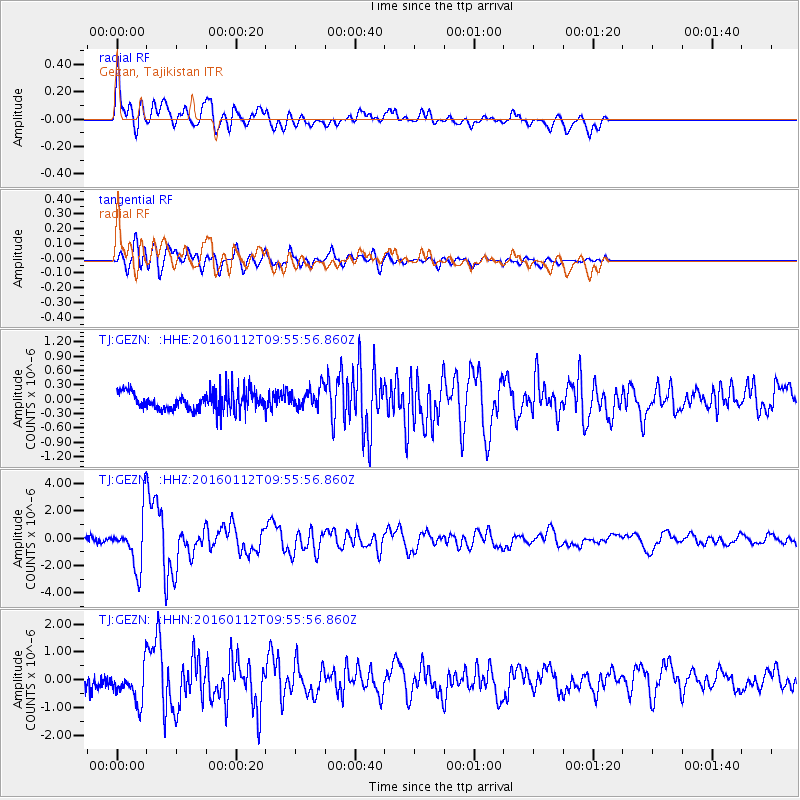
Signal To Noise
| Channel | StoN | STA | LTA |
| TJ:GEZN: :HHZ:20160112T09:55:56.860Z | 11.969629 | 1.9502957E-6 | 1.6293701E-7 |
| TJ:GEZN: :HHN:20160112T09:55:56.860Z | 2.5293355 | 6.542248E-7 | 2.586548E-7 |
| TJ:GEZN: :HHE:20160112T09:55:56.860Z | 0.9594489 | 1.9485708E-7 | 2.0309272E-7 |
| Arrivals |
| Ps | 4.0 SECOND |
| PpPs | 15 SECOND |
| PsPs/PpSs | 19 SECOND |


