You are here: Home > Network List > TA - USArray Transportable Network (new EarthScope stations) Stations List
> Station G03D McMinnville, OR, USA > Earthquake Result Viewer
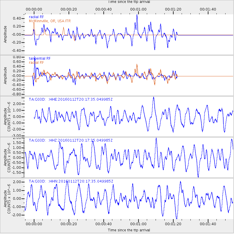
G03D McMinnville, OR, USA - Earthquake Result Viewer
*The percent match for this event was below the threshold and hence no stack was calculated.
| Earthquake location: |
Hindu Kush Region, Afghanistan |
| Earthquake latitude/longitude: |
36.6/71.0 |
| Earthquake time(UTC): |
2016/01/12 (012) 20:04:59 GMT |
| Earthquake Depth: |
239 km |
| Earthquake Magnitude: |
5.7 MWW, 5.7 MWB, 5.7 MWC |
| Earthquake Catalog/Contributor: |
NEIC PDE/NEIC COMCAT |
|
| Network: |
TA USArray Transportable Network (new EarthScope stations) |
| Station: |
G03D McMinnville, OR, USA |
| Lat/Lon: |
45.21 N/123.26 W |
| Elevation: |
222 m |
|
| Distance: |
97.6 deg |
| Az: |
10.089 deg |
| Baz: |
348.492 deg |
| Ray Param: |
$rayparam |
*The percent match for this event was below the threshold and hence was not used in the summary stack. |
|
| Radial Match: |
59.87954 % |
| Radial Bump: |
400 |
| Transverse Match: |
66.018295 % |
| Transverse Bump: |
400 |
| SOD ConfigId: |
7422571 |
| Insert Time: |
2019-04-21 17:42:55.095 +0000 |
| GWidth: |
2.5 |
| Max Bumps: |
400 |
| Tol: |
0.001 |
|
Signal To Noise
| Channel | StoN | STA | LTA |
| TA:G03D: :HHZ:20160112T20:17:35.049985Z | 0.63637054 | 4.6321776E-7 | 7.2790573E-7 |
| TA:G03D: :HHN:20160112T20:17:35.049985Z | 1.1080568 | 9.284935E-7 | 8.3794754E-7 |
| TA:G03D: :HHE:20160112T20:17:35.049985Z | 1.3320553 | 7.938776E-7 | 5.9597943E-7 |
| Arrivals |
| Ps | |
| PpPs | |
| PsPs/PpSs | |


