You are here: Home > Network List > US - United States National Seismic Network Stations List
> Station MNTX Cornudas Mountains, Texas, USA > Earthquake Result Viewer
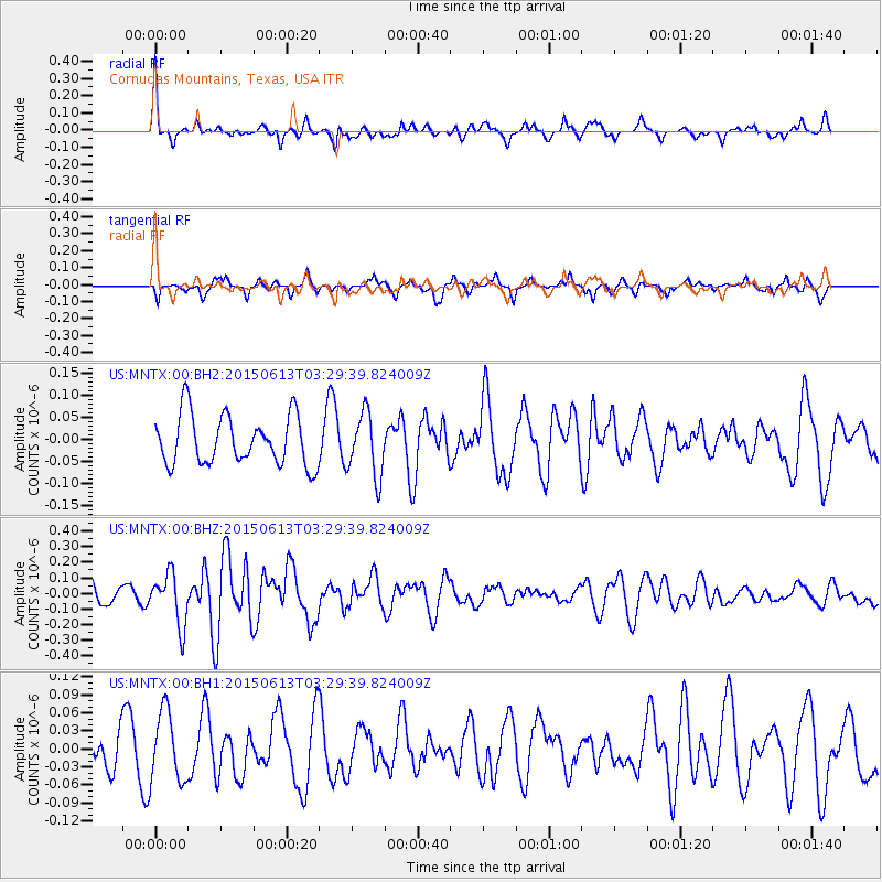
MNTX Cornudas Mountains, Texas, USA - Earthquake Result Viewer
*The percent match for this event was below the threshold and hence no stack was calculated.
| Earthquake location: |
South Of Fiji Islands |
| Earthquake latitude/longitude: |
-24.6/-176.2 |
| Earthquake time(UTC): |
2015/06/13 (164) 03:17:24 GMT |
| Earthquake Depth: |
22 km |
| Earthquake Magnitude: |
5.5 MWW, 5.5 MWB, 5.6 MWC |
| Earthquake Catalog/Contributor: |
NEIC PDE/NEIC COMCAT |
|
| Network: |
US United States National Seismic Network |
| Station: |
MNTX Cornudas Mountains, Texas, USA |
| Lat/Lon: |
31.70 N/105.38 W |
| Elevation: |
404 m |
|
| Distance: |
87.8 deg |
| Az: |
53.665 deg |
| Baz: |
239.355 deg |
| Ray Param: |
$rayparam |
*The percent match for this event was below the threshold and hence was not used in the summary stack. |
|
| Radial Match: |
67.06712 % |
| Radial Bump: |
326 |
| Transverse Match: |
49.906494 % |
| Transverse Bump: |
291 |
| SOD ConfigId: |
976571 |
| Insert Time: |
2015-07-17 00:16:58.166 +0000 |
| GWidth: |
2.5 |
| Max Bumps: |
400 |
| Tol: |
0.001 |
|
Signal To Noise
| Channel | StoN | STA | LTA |
| US:MNTX:00:BHZ:20150613T03:29:39.824009Z | 1.8202058 | 1.6459342E-7 | 9.0425715E-8 |
| US:MNTX:00:BH1:20150613T03:29:39.824009Z | 1.5072038 | 5.7793315E-8 | 3.8344727E-8 |
| US:MNTX:00:BH2:20150613T03:29:39.824009Z | 1.2865889 | 7.184904E-8 | 5.5844595E-8 |
| Arrivals |
| Ps | |
| PpPs | |
| PsPs/PpSs | |


