You are here: Home > Network List > AZ - ANZA Regional Network Stations List
> Station LVA2 AZ.LVA2 > Earthquake Result Viewer
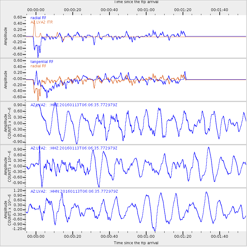
LVA2 AZ.LVA2 - Earthquake Result Viewer
*The percent match for this event was below the threshold and hence no stack was calculated.
| Earthquake location: |
Tonga Islands |
| Earthquake latitude/longitude: |
-15.2/-174.9 |
| Earthquake time(UTC): |
2016/01/13 (013) 05:55:59 GMT |
| Earthquake Depth: |
233 km |
| Earthquake Magnitude: |
5.8 MB |
| Earthquake Catalog/Contributor: |
NEIC PDE/NEIC COMCAT |
|
| Network: |
AZ ANZA Regional Network |
| Station: |
LVA2 AZ.LVA2 |
| Lat/Lon: |
33.35 N/116.56 W |
| Elevation: |
1435 m |
|
| Distance: |
73.6 deg |
| Az: |
47.944 deg |
| Baz: |
238.922 deg |
| Ray Param: |
$rayparam |
*The percent match for this event was below the threshold and hence was not used in the summary stack. |
|
| Radial Match: |
78.427986 % |
| Radial Bump: |
400 |
| Transverse Match: |
66.47945 % |
| Transverse Bump: |
400 |
| SOD ConfigId: |
7422571 |
| Insert Time: |
2019-04-21 17:45:39.936 +0000 |
| GWidth: |
2.5 |
| Max Bumps: |
400 |
| Tol: |
0.001 |
|
Signal To Noise
| Channel | StoN | STA | LTA |
| AZ:LVA2: :HHZ:20160113T06:06:35.772979Z | 1.1157517 | 5.0699816E-7 | 4.544005E-7 |
| AZ:LVA2: :HHN:20160113T06:06:35.772979Z | 0.58908904 | 2.5983823E-7 | 4.410848E-7 |
| AZ:LVA2: :HHE:20160113T06:06:35.772979Z | 0.6032544 | 3.3743322E-7 | 5.5935476E-7 |
| Arrivals |
| Ps | |
| PpPs | |
| PsPs/PpSs | |


