You are here: Home > Network List > CN - Canadian National Seismograph Network Stations List
> Station INK INUVIK, NT > Earthquake Result Viewer
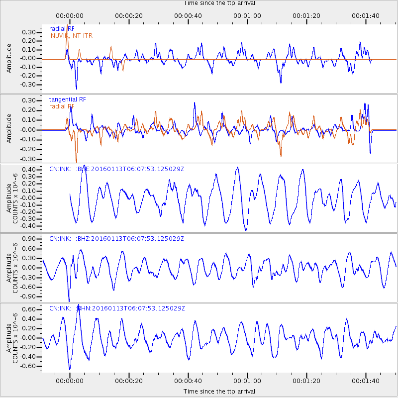
INK INUVIK, NT - Earthquake Result Viewer
*The percent match for this event was below the threshold and hence no stack was calculated.
| Earthquake location: |
Tonga Islands |
| Earthquake latitude/longitude: |
-15.2/-174.9 |
| Earthquake time(UTC): |
2016/01/13 (013) 05:55:59 GMT |
| Earthquake Depth: |
233 km |
| Earthquake Magnitude: |
5.8 MB |
| Earthquake Catalog/Contributor: |
NEIC PDE/NEIC COMCAT |
|
| Network: |
CN Canadian National Seismograph Network |
| Station: |
INK INUVIK, NT |
| Lat/Lon: |
68.31 N/133.53 W |
| Elevation: |
44 m |
|
| Distance: |
88.4 deg |
| Az: |
14.232 deg |
| Baz: |
219.674 deg |
| Ray Param: |
$rayparam |
*The percent match for this event was below the threshold and hence was not used in the summary stack. |
|
| Radial Match: |
63.580643 % |
| Radial Bump: |
363 |
| Transverse Match: |
59.710297 % |
| Transverse Bump: |
367 |
| SOD ConfigId: |
7422571 |
| Insert Time: |
2019-04-21 17:46:56.717 +0000 |
| GWidth: |
2.5 |
| Max Bumps: |
400 |
| Tol: |
0.001 |
|
Signal To Noise
| Channel | StoN | STA | LTA |
| CN:INK: :BHZ:20160113T06:07:53.125029Z | 1.8320328 | 4.547088E-7 | 2.4819906E-7 |
| CN:INK: :BHN:20160113T06:07:53.125029Z | 1.8050382 | 4.1144966E-7 | 2.2794512E-7 |
| CN:INK: :BHE:20160113T06:07:53.125029Z | 0.8485116 | 1.6233184E-7 | 1.9131363E-7 |
| Arrivals |
| Ps | |
| PpPs | |
| PsPs/PpSs | |


