You are here: Home > Network List > TA - USArray Transportable Network (new EarthScope stations) Stations List
> Station A21K Barrow, AK, USA > Earthquake Result Viewer
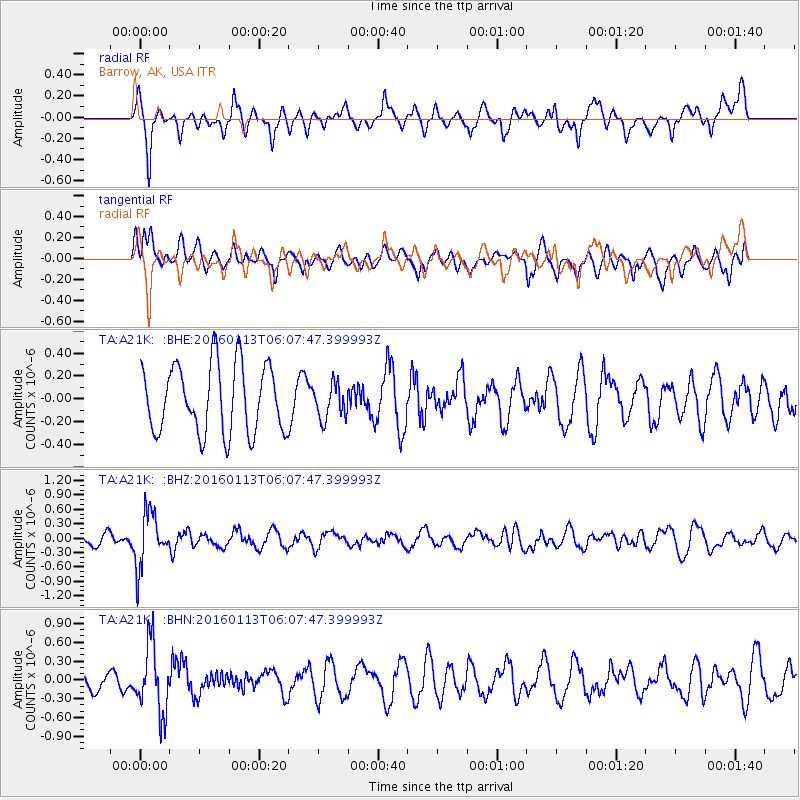
A21K Barrow, AK, USA - Earthquake Result Viewer
*The percent match for this event was below the threshold and hence no stack was calculated.
| Earthquake location: |
Tonga Islands |
| Earthquake latitude/longitude: |
-15.2/-174.9 |
| Earthquake time(UTC): |
2016/01/13 (013) 05:55:59 GMT |
| Earthquake Depth: |
233 km |
| Earthquake Magnitude: |
5.8 MB |
| Earthquake Catalog/Contributor: |
NEIC PDE/NEIC COMCAT |
|
| Network: |
TA USArray Transportable Network (new EarthScope stations) |
| Station: |
A21K Barrow, AK, USA |
| Lat/Lon: |
71.32 N/156.62 W |
| Elevation: |
577 m |
|
| Distance: |
87.2 deg |
| Az: |
5.808 deg |
| Baz: |
197.653 deg |
| Ray Param: |
$rayparam |
*The percent match for this event was below the threshold and hence was not used in the summary stack. |
|
| Radial Match: |
69.695015 % |
| Radial Bump: |
400 |
| Transverse Match: |
50.412945 % |
| Transverse Bump: |
400 |
| SOD ConfigId: |
7422571 |
| Insert Time: |
2019-04-21 17:49:42.042 +0000 |
| GWidth: |
2.5 |
| Max Bumps: |
400 |
| Tol: |
0.001 |
|
Signal To Noise
| Channel | StoN | STA | LTA |
| TA:A21K: :BHZ:20160113T06:07:47.399993Z | 4.0641055 | 5.602251E-7 | 1.3784708E-7 |
| TA:A21K: :BHN:20160113T06:07:47.399993Z | 2.5926151 | 5.336201E-7 | 2.0582311E-7 |
| TA:A21K: :BHE:20160113T06:07:47.399993Z | 0.5040696 | 1.4961965E-7 | 2.9682337E-7 |
| Arrivals |
| Ps | |
| PpPs | |
| PsPs/PpSs | |


