You are here: Home > Network List > CI - Caltech Regional Seismic Network Stations List
> Station SMM Simmler, CA, USA > Earthquake Result Viewer
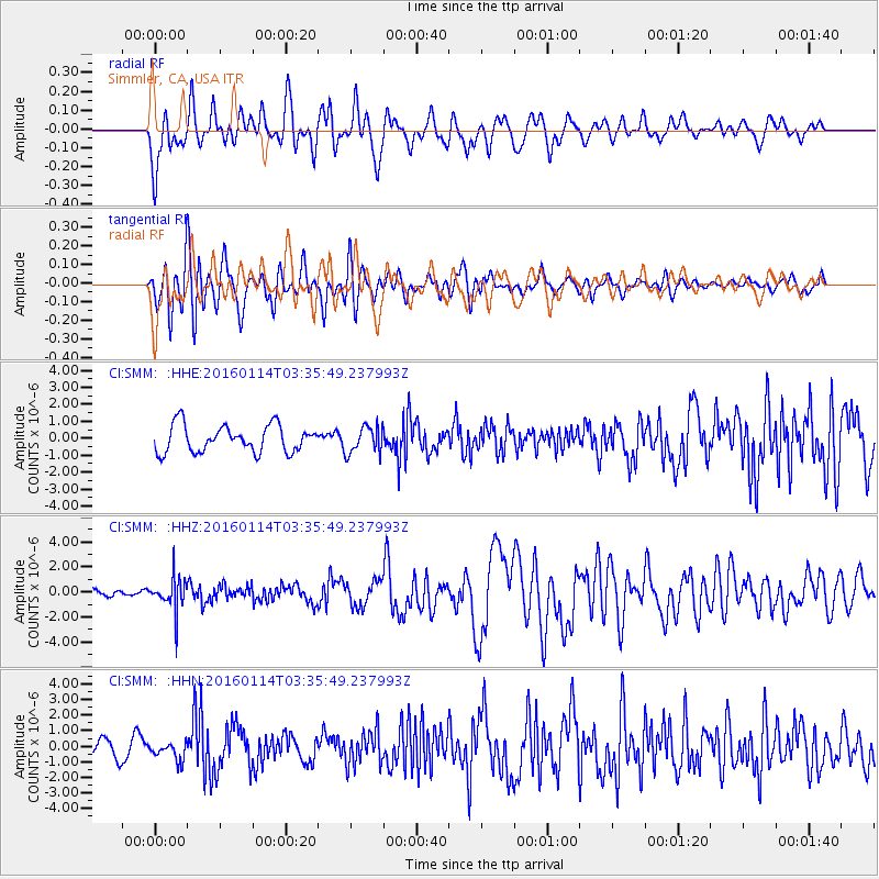
SMM Simmler, CA, USA - Earthquake Result Viewer
*The percent match for this event was below the threshold and hence no stack was calculated.
| Earthquake location: |
Southern Bolivia |
| Earthquake latitude/longitude: |
-19.8/-63.3 |
| Earthquake time(UTC): |
2016/01/14 (014) 03:25:28 GMT |
| Earthquake Depth: |
582 km |
| Earthquake Magnitude: |
6.1 MWW, 6.1 MWB |
| Earthquake Catalog/Contributor: |
NEIC PDE/NEIC COMCAT |
|
| Network: |
CI Caltech Regional Seismic Network |
| Station: |
SMM Simmler, CA, USA |
| Lat/Lon: |
35.31 N/120.00 W |
| Elevation: |
599 m |
|
| Distance: |
76.8 deg |
| Az: |
315.395 deg |
| Baz: |
126.064 deg |
| Ray Param: |
$rayparam |
*The percent match for this event was below the threshold and hence was not used in the summary stack. |
|
| Radial Match: |
71.51084 % |
| Radial Bump: |
400 |
| Transverse Match: |
68.781395 % |
| Transverse Bump: |
400 |
| SOD ConfigId: |
7422571 |
| Insert Time: |
2019-04-21 17:59:49.023 +0000 |
| GWidth: |
2.5 |
| Max Bumps: |
400 |
| Tol: |
0.001 |
|
Signal To Noise
| Channel | StoN | STA | LTA |
| CI:SMM: :HHZ:20160114T03:35:49.237993Z | 3.0514824 | 1.2792226E-6 | 4.1921348E-7 |
| CI:SMM: :HHN:20160114T03:35:49.237993Z | 1.0317758 | 5.9258804E-7 | 5.74338E-7 |
| CI:SMM: :HHE:20160114T03:35:49.237993Z | 0.98043185 | 7.7425744E-7 | 7.897106E-7 |
| Arrivals |
| Ps | |
| PpPs | |
| PsPs/PpSs | |


