You are here: Home > Network List > LD - Lamont-Doherty Cooperative Seismographic Network Stations List
> Station MVL Millersville University, PA > Earthquake Result Viewer
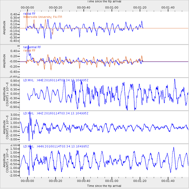
MVL Millersville University, PA - Earthquake Result Viewer
*The percent match for this event was below the threshold and hence no stack was calculated.
| Earthquake location: |
Southern Bolivia |
| Earthquake latitude/longitude: |
-19.8/-63.3 |
| Earthquake time(UTC): |
2016/01/14 (014) 03:25:28 GMT |
| Earthquake Depth: |
582 km |
| Earthquake Magnitude: |
6.1 MWW, 6.1 MWB |
| Earthquake Catalog/Contributor: |
NEIC PDE/NEIC COMCAT |
|
| Network: |
LD Lamont-Doherty Cooperative Seismographic Network |
| Station: |
MVL Millersville University, PA |
| Lat/Lon: |
40.00 N/76.35 W |
| Elevation: |
91 m |
|
| Distance: |
60.8 deg |
| Az: |
348.52 deg |
| Baz: |
165.882 deg |
| Ray Param: |
$rayparam |
*The percent match for this event was below the threshold and hence was not used in the summary stack. |
|
| Radial Match: |
58.815357 % |
| Radial Bump: |
393 |
| Transverse Match: |
69.10957 % |
| Transverse Bump: |
400 |
| SOD ConfigId: |
7422571 |
| Insert Time: |
2019-04-21 18:01:39.615 +0000 |
| GWidth: |
2.5 |
| Max Bumps: |
400 |
| Tol: |
0.001 |
|
Signal To Noise
| Channel | StoN | STA | LTA |
| LD:MVL: :HHZ:20160114T03:34:13.164995Z | 2.8446267 | 1.5205496E-6 | 5.34534E-7 |
| LD:MVL: :HHN:20160114T03:34:13.164995Z | 2.0759914 | 1.0255047E-6 | 4.939831E-7 |
| LD:MVL: :HHE:20160114T03:34:13.164995Z | 1.7818552 | 4.735578E-7 | 2.6576672E-7 |
| Arrivals |
| Ps | |
| PpPs | |
| PsPs/PpSs | |


