You are here: Home > Network List > UW - Pacific Northwest Regional Seismic Network Stations List
> Station MRBL Marblemount, WA, USA > Earthquake Result Viewer
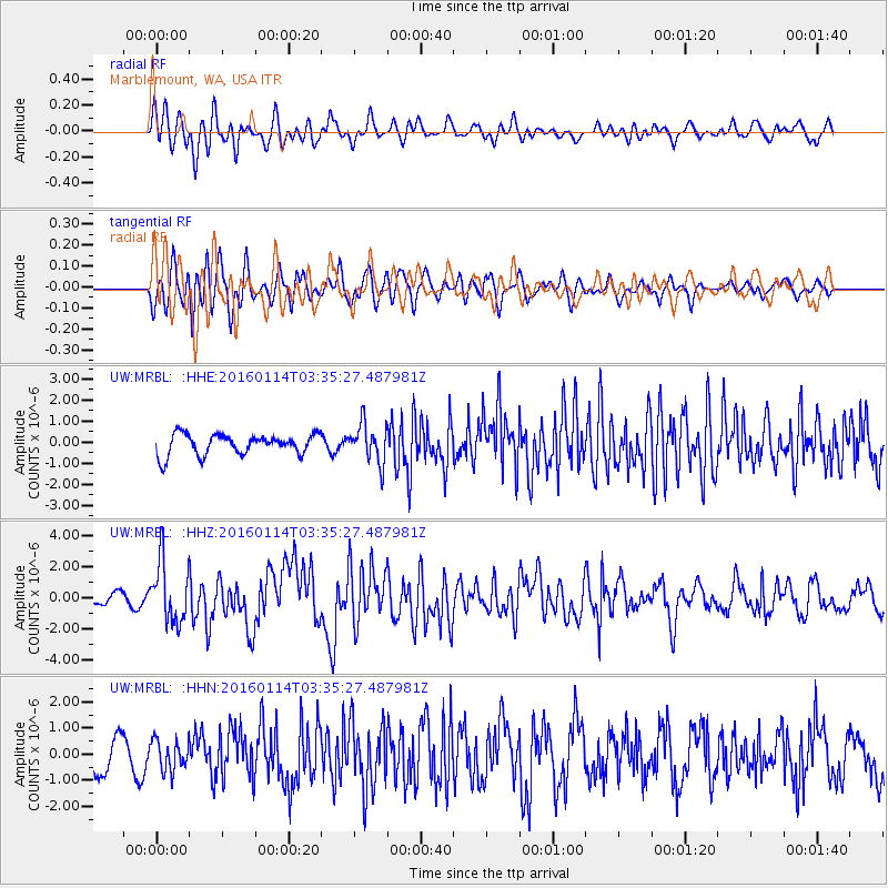
MRBL Marblemount, WA, USA - Earthquake Result Viewer
*The percent match for this event was below the threshold and hence no stack was calculated.
| Earthquake location: |
Hokkaido, Japan Region |
| Earthquake latitude/longitude: |
42.0/142.7 |
| Earthquake time(UTC): |
2016/01/14 (014) 03:25:34 GMT |
| Earthquake Depth: |
51 km |
| Earthquake Magnitude: |
6.7 MWP, 6.7 MI |
| Earthquake Catalog/Contributor: |
NEIC PDE/NEIC COMCAT |
|
| Network: |
UW Pacific Northwest Regional Seismic Network |
| Station: |
MRBL Marblemount, WA, USA |
| Lat/Lon: |
48.52 N/121.48 W |
| Elevation: |
75 m |
|
| Distance: |
63.4 deg |
| Az: |
47.7 deg |
| Baz: |
303.921 deg |
| Ray Param: |
$rayparam |
*The percent match for this event was below the threshold and hence was not used in the summary stack. |
|
| Radial Match: |
71.89163 % |
| Radial Bump: |
400 |
| Transverse Match: |
75.90364 % |
| Transverse Bump: |
400 |
| SOD ConfigId: |
7422571 |
| Insert Time: |
2019-04-21 18:24:17.351 +0000 |
| GWidth: |
2.5 |
| Max Bumps: |
400 |
| Tol: |
0.001 |
|
Signal To Noise
| Channel | StoN | STA | LTA |
| UW:MRBL: :HHZ:20160114T03:35:27.487981Z | 6.0908737 | 1.9527101E-6 | 3.2059606E-7 |
| UW:MRBL: :HHN:20160114T03:35:27.487981Z | 1.1174886 | 5.7441787E-7 | 5.1402566E-7 |
| UW:MRBL: :HHE:20160114T03:35:27.487981Z | 1.9178642 | 9.4247076E-7 | 4.9141687E-7 |
| Arrivals |
| Ps | |
| PpPs | |
| PsPs/PpSs | |


