You are here: Home > Network List > IU - Global Seismograph Network (GSN - IRIS/USGS) Stations List
> Station PMG Port Moresby, New Guinea > Earthquake Result Viewer
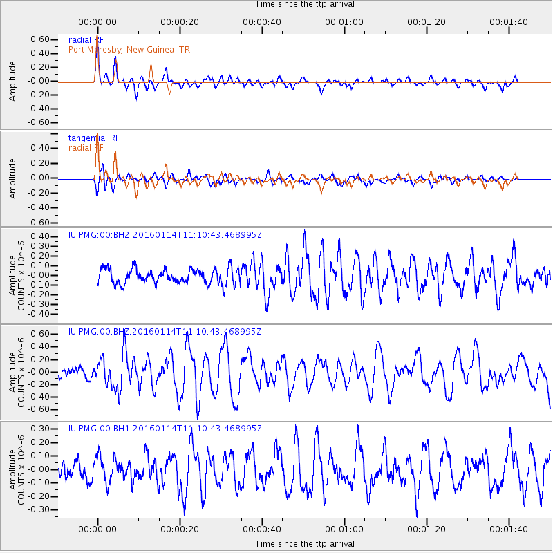
PMG Port Moresby, New Guinea - Earthquake Result Viewer
*The percent match for this event was below the threshold and hence no stack was calculated.
| Earthquake location: |
Fiji Islands Region |
| Earthquake latitude/longitude: |
-15.6/-177.2 |
| Earthquake time(UTC): |
2016/01/14 (014) 11:04:18 GMT |
| Earthquake Depth: |
10 km |
| Earthquake Magnitude: |
5.6 mwb |
| Earthquake Catalog/Contributor: |
NEIC PDE/us |
|
| Network: |
IU Global Seismograph Network (GSN - IRIS/USGS) |
| Station: |
PMG Port Moresby, New Guinea |
| Lat/Lon: |
9.40 S/147.16 E |
| Elevation: |
90 m |
|
| Distance: |
35.3 deg |
| Az: |
275.787 deg |
| Baz: |
103.732 deg |
| Ray Param: |
$rayparam |
*The percent match for this event was below the threshold and hence was not used in the summary stack. |
|
| Radial Match: |
73.959404 % |
| Radial Bump: |
400 |
| Transverse Match: |
70.50375 % |
| Transverse Bump: |
400 |
| SOD ConfigId: |
7422571 |
| Insert Time: |
2019-04-21 18:30:29.443 +0000 |
| GWidth: |
2.5 |
| Max Bumps: |
400 |
| Tol: |
0.001 |
|
Signal To Noise
| Channel | StoN | STA | LTA |
| IU:PMG:00:BHZ:20160114T11:10:43.468995Z | 2.185068 | 1.9258977E-7 | 8.813903E-8 |
| IU:PMG:00:BH1:20160114T11:10:43.468995Z | 1.4534886 | 9.6741594E-8 | 6.655821E-8 |
| IU:PMG:00:BH2:20160114T11:10:43.468995Z | 1.4359009 | 9.929892E-8 | 6.9154446E-8 |
| Arrivals |
| Ps | |
| PpPs | |
| PsPs/PpSs | |


