You are here: Home > Network List > TA - USArray Transportable Network (new EarthScope stations) Stations List
> Station X43A Marvell, AR, USA > Earthquake Result Viewer
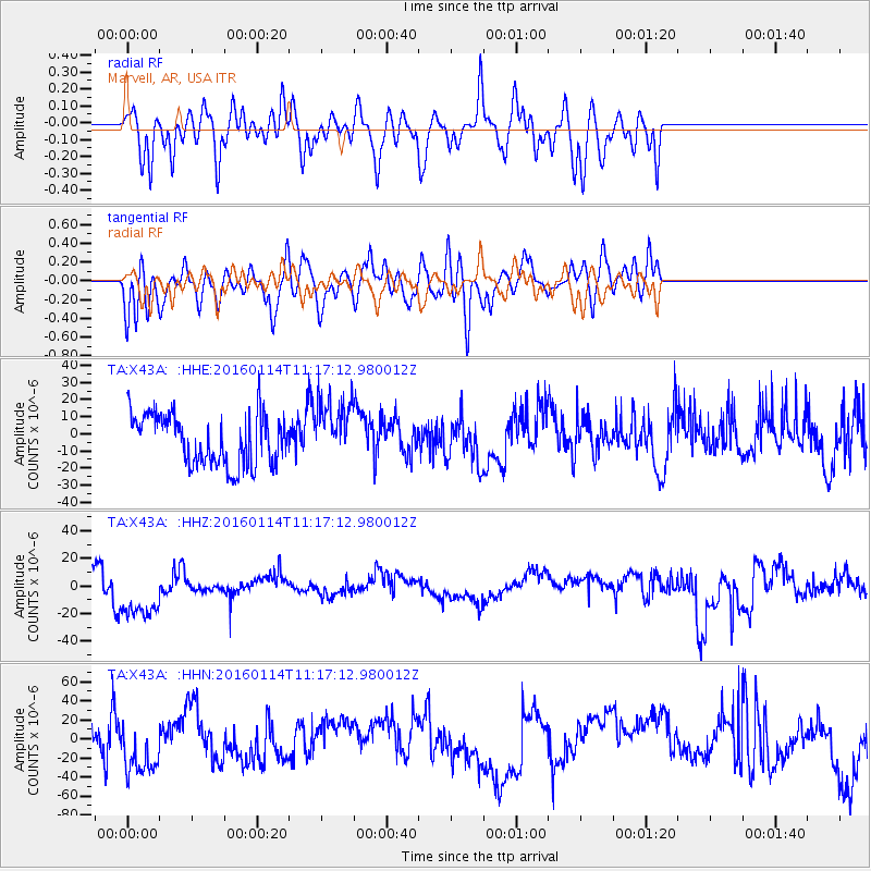
X43A Marvell, AR, USA - Earthquake Result Viewer
*The percent match for this event was below the threshold and hence no stack was calculated.
| Earthquake location: |
Fiji Islands Region |
| Earthquake latitude/longitude: |
-15.6/-177.2 |
| Earthquake time(UTC): |
2016/01/14 (014) 11:04:18 GMT |
| Earthquake Depth: |
10 km |
| Earthquake Magnitude: |
5.6 mwb |
| Earthquake Catalog/Contributor: |
NEIC PDE/us |
|
| Network: |
TA USArray Transportable Network (new EarthScope stations) |
| Station: |
X43A Marvell, AR, USA |
| Lat/Lon: |
34.52 N/90.88 W |
| Elevation: |
53 m |
|
| Distance: |
95.7 deg |
| Az: |
55.902 deg |
| Baz: |
255.059 deg |
| Ray Param: |
$rayparam |
*The percent match for this event was below the threshold and hence was not used in the summary stack. |
|
| Radial Match: |
54.86564 % |
| Radial Bump: |
400 |
| Transverse Match: |
49.323696 % |
| Transverse Bump: |
400 |
| SOD ConfigId: |
7422571 |
| Insert Time: |
2019-04-21 18:32:36.496 +0000 |
| GWidth: |
2.5 |
| Max Bumps: |
400 |
| Tol: |
0.001 |
|
Signal To Noise
| Channel | StoN | STA | LTA |
| TA:X43A: :HHZ:20160114T11:17:12.980012Z | 1.752756 | 2.0735699E-5 | 1.183034E-5 |
| TA:X43A: :HHN:20160114T11:17:12.980012Z | 1.4189633 | 2.7190385E-5 | 1.9162148E-5 |
| TA:X43A: :HHE:20160114T11:17:12.980012Z | 1.2072837 | 1.8143364E-5 | 1.5028251E-5 |
| Arrivals |
| Ps | |
| PpPs | |
| PsPs/PpSs | |


