You are here: Home > Network List > KN - Kyrgyz Seismic Telemetry Network Stations List
> Station TKM2 - > Earthquake Result Viewer
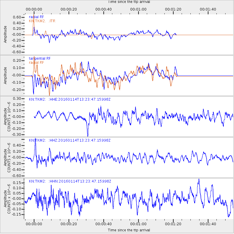
TKM2 - - Earthquake Result Viewer
*The percent match for this event was below the threshold and hence no stack was calculated.
| Earthquake location: |
Mindanao, Philippines |
| Earthquake latitude/longitude: |
9.7/126.4 |
| Earthquake time(UTC): |
2016/01/14 (014) 13:14:49 GMT |
| Earthquake Depth: |
35 km |
| Earthquake Magnitude: |
5.6 MB |
| Earthquake Catalog/Contributor: |
NEIC PDE/NEIC COMCAT |
|
| Network: |
KN Kyrgyz Seismic Telemetry Network |
| Station: |
TKM2 - |
| Lat/Lon: |
42.92 N/75.60 E |
| Elevation: |
2020 m |
|
| Distance: |
55.1 deg |
| Az: |
316.09 deg |
| Baz: |
111.443 deg |
| Ray Param: |
$rayparam |
*The percent match for this event was below the threshold and hence was not used in the summary stack. |
|
| Radial Match: |
62.015175 % |
| Radial Bump: |
400 |
| Transverse Match: |
43.613895 % |
| Transverse Bump: |
400 |
| SOD ConfigId: |
7422571 |
| Insert Time: |
2019-04-21 18:38:23.783 +0000 |
| GWidth: |
2.5 |
| Max Bumps: |
400 |
| Tol: |
0.001 |
|
Signal To Noise
| Channel | StoN | STA | LTA |
| KN:TKM2: :HHZ:20160114T13:23:47.15998Z | 3.0992808 | 2.1504952E-7 | 6.938691E-8 |
| KN:TKM2: :HHN:20160114T13:23:47.15998Z | 1.1515279 | 4.7651795E-8 | 4.1381362E-8 |
| KN:TKM2: :HHE:20160114T13:23:47.15998Z | 2.982578 | 1.2611814E-7 | 4.228494E-8 |
| Arrivals |
| Ps | |
| PpPs | |
| PsPs/PpSs | |


