You are here: Home > Network List > UW - Pacific Northwest Regional Seismic Network Stations List
> Station PASS Maple Falls, WA, USA > Earthquake Result Viewer
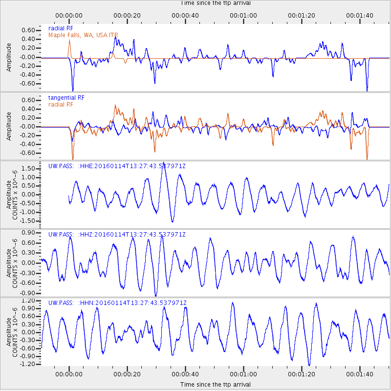
PASS Maple Falls, WA, USA - Earthquake Result Viewer
*The percent match for this event was below the threshold and hence no stack was calculated.
| Earthquake location: |
Mindanao, Philippines |
| Earthquake latitude/longitude: |
9.7/126.4 |
| Earthquake time(UTC): |
2016/01/14 (014) 13:14:49 GMT |
| Earthquake Depth: |
35 km |
| Earthquake Magnitude: |
5.6 MB |
| Earthquake Catalog/Contributor: |
NEIC PDE/NEIC COMCAT |
|
| Network: |
UW Pacific Northwest Regional Seismic Network |
| Station: |
PASS Maple Falls, WA, USA |
| Lat/Lon: |
49.00 N/122.09 W |
| Elevation: |
174 m |
|
| Distance: |
96.5 deg |
| Az: |
38.061 deg |
| Baz: |
292.652 deg |
| Ray Param: |
$rayparam |
*The percent match for this event was below the threshold and hence was not used in the summary stack. |
|
| Radial Match: |
52.94767 % |
| Radial Bump: |
400 |
| Transverse Match: |
35.962032 % |
| Transverse Bump: |
400 |
| SOD ConfigId: |
7422571 |
| Insert Time: |
2019-04-21 18:39:42.299 +0000 |
| GWidth: |
2.5 |
| Max Bumps: |
400 |
| Tol: |
0.001 |
|
Signal To Noise
| Channel | StoN | STA | LTA |
| UW:PASS: :HHZ:20160114T13:27:43.537971Z | 1.334721 | 3.9952454E-7 | 2.993319E-7 |
| UW:PASS: :HHN:20160114T13:27:43.537971Z | 0.9529397 | 4.906275E-7 | 5.148568E-7 |
| UW:PASS: :HHE:20160114T13:27:43.537971Z | 2.5895143 | 1.0422989E-6 | 4.025075E-7 |
| Arrivals |
| Ps | |
| PpPs | |
| PsPs/PpSs | |


