You are here: Home > Network List > KN - Kyrgyz Seismic Telemetry Network Stations List
> Station TKM2 - > Earthquake Result Viewer
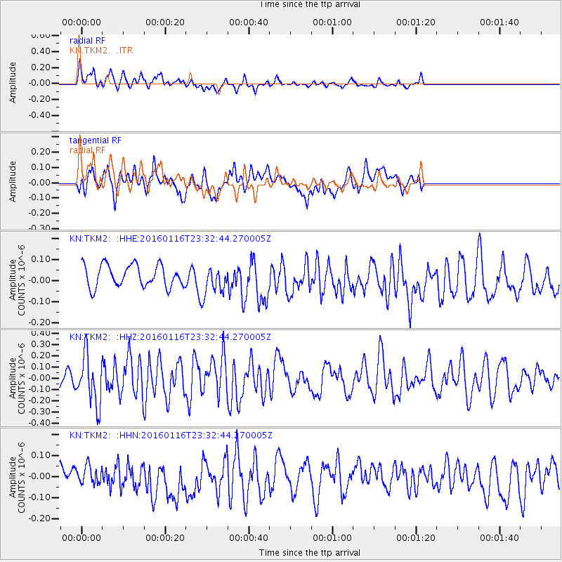
TKM2 - - Earthquake Result Viewer
*The percent match for this event was below the threshold and hence no stack was calculated.
| Earthquake location: |
Seram, Indonesia |
| Earthquake latitude/longitude: |
-3.9/127.2 |
| Earthquake time(UTC): |
2016/01/16 (016) 23:22:35 GMT |
| Earthquake Depth: |
46 km |
| Earthquake Magnitude: |
5.5 MB |
| Earthquake Catalog/Contributor: |
NEIC PDE/NEIC COMCAT |
|
| Network: |
KN Kyrgyz Seismic Telemetry Network |
| Station: |
TKM2 - |
| Lat/Lon: |
42.92 N/75.60 E |
| Elevation: |
2020 m |
|
| Distance: |
65.8 deg |
| Az: |
320.854 deg |
| Baz: |
120.965 deg |
| Ray Param: |
$rayparam |
*The percent match for this event was below the threshold and hence was not used in the summary stack. |
|
| Radial Match: |
66.03707 % |
| Radial Bump: |
400 |
| Transverse Match: |
49.023727 % |
| Transverse Bump: |
400 |
| SOD ConfigId: |
7422571 |
| Insert Time: |
2019-04-21 18:42:28.482 +0000 |
| GWidth: |
2.5 |
| Max Bumps: |
400 |
| Tol: |
0.001 |
|
Signal To Noise
| Channel | StoN | STA | LTA |
| KN:TKM2: :HHZ:20160116T23:32:44.270005Z | 4.137424 | 2.2179493E-7 | 5.360701E-8 |
| KN:TKM2: :HHN:20160116T23:32:44.270005Z | 0.8738904 | 4.219071E-8 | 4.827918E-8 |
| KN:TKM2: :HHE:20160116T23:32:44.270005Z | 1.0058533 | 5.118283E-8 | 5.088498E-8 |
| Arrivals |
| Ps | |
| PpPs | |
| PsPs/PpSs | |


