You are here: Home > Network List > TA - USArray Transportable Network (new EarthScope stations) Stations List
> Station L19K White Mountain, AK, USA > Earthquake Result Viewer
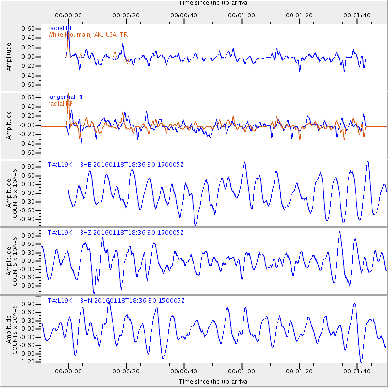
L19K White Mountain, AK, USA - Earthquake Result Viewer
*The percent match for this event was below the threshold and hence no stack was calculated.
| Earthquake location: |
South Of Fiji Islands |
| Earthquake latitude/longitude: |
-21.5/176.2 |
| Earthquake time(UTC): |
2016/01/18 (018) 18:24:17 GMT |
| Earthquake Depth: |
4.7 km |
| Earthquake Magnitude: |
5.8 MWW, 5.8 MWB, 5.9 MWC |
| Earthquake Catalog/Contributor: |
NEIC PDE/NEIC COMCAT |
|
| Network: |
TA USArray Transportable Network (new EarthScope stations) |
| Station: |
L19K White Mountain, AK, USA |
| Lat/Lon: |
62.18 N/154.85 W |
| Elevation: |
650 m |
|
| Distance: |
86.5 deg |
| Az: |
13.16 deg |
| Baz: |
206.876 deg |
| Ray Param: |
$rayparam |
*The percent match for this event was below the threshold and hence was not used in the summary stack. |
|
| Radial Match: |
48.16792 % |
| Radial Bump: |
400 |
| Transverse Match: |
56.564213 % |
| Transverse Bump: |
400 |
| SOD ConfigId: |
7422571 |
| Insert Time: |
2019-04-21 18:48:36.598 +0000 |
| GWidth: |
2.5 |
| Max Bumps: |
400 |
| Tol: |
0.001 |
|
Signal To Noise
| Channel | StoN | STA | LTA |
| TA:L19K: :BHZ:20160118T18:36:30.150005Z | 1.353928 | 3.8012854E-7 | 2.807598E-7 |
| TA:L19K: :BHN:20160118T18:36:30.150005Z | 2.2224643 | 5.4376306E-7 | 2.4466675E-7 |
| TA:L19K: :BHE:20160118T18:36:30.150005Z | 0.8384402 | 3.0939086E-7 | 3.6900767E-7 |
| Arrivals |
| Ps | |
| PpPs | |
| PsPs/PpSs | |


