You are here: Home > Network List > UW - Pacific Northwest Regional Seismic Network Stations List
> Station PASS Maple Falls, WA, USA > Earthquake Result Viewer
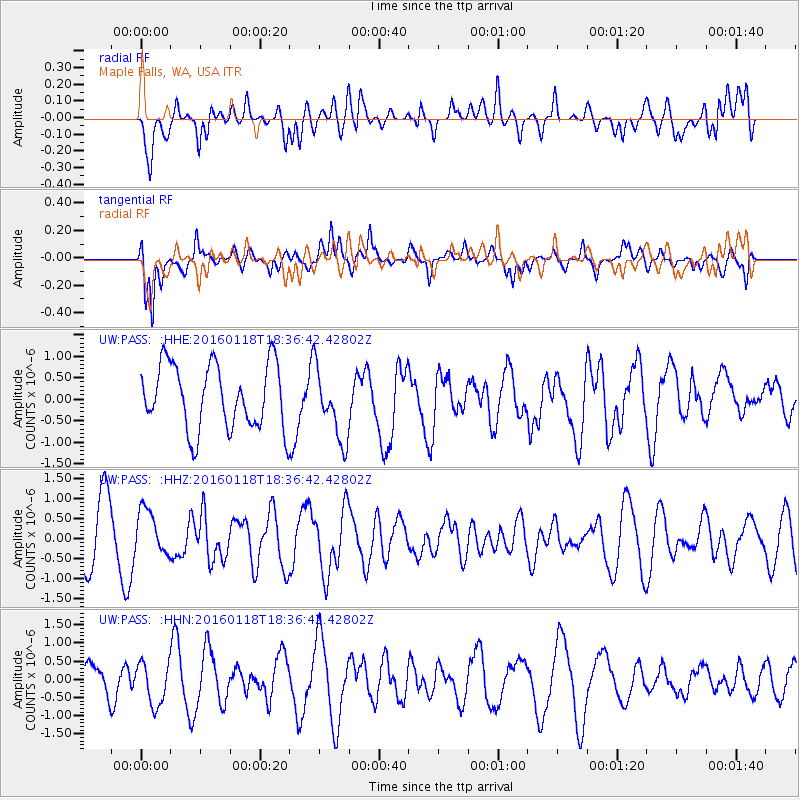
PASS Maple Falls, WA, USA - Earthquake Result Viewer
*The percent match for this event was below the threshold and hence no stack was calculated.
| Earthquake location: |
South Of Fiji Islands |
| Earthquake latitude/longitude: |
-21.5/176.2 |
| Earthquake time(UTC): |
2016/01/18 (018) 18:24:17 GMT |
| Earthquake Depth: |
4.7 km |
| Earthquake Magnitude: |
5.8 MWW, 5.8 MWB, 5.9 MWC |
| Earthquake Catalog/Contributor: |
NEIC PDE/NEIC COMCAT |
|
| Network: |
UW Pacific Northwest Regional Seismic Network |
| Station: |
PASS Maple Falls, WA, USA |
| Lat/Lon: |
49.00 N/122.09 W |
| Elevation: |
174 m |
|
| Distance: |
89.0 deg |
| Az: |
35.463 deg |
| Baz: |
235.147 deg |
| Ray Param: |
$rayparam |
*The percent match for this event was below the threshold and hence was not used in the summary stack. |
|
| Radial Match: |
49.86719 % |
| Radial Bump: |
400 |
| Transverse Match: |
66.64366 % |
| Transverse Bump: |
400 |
| SOD ConfigId: |
7422571 |
| Insert Time: |
2019-04-21 18:49:11.263 +0000 |
| GWidth: |
2.5 |
| Max Bumps: |
400 |
| Tol: |
0.001 |
|
Signal To Noise
| Channel | StoN | STA | LTA |
| UW:PASS: :HHZ:20160118T18:36:42.42802Z | 0.7363499 | 5.6089954E-7 | 7.6172967E-7 |
| UW:PASS: :HHN:20160118T18:36:42.42802Z | 1.3277748 | 5.8560954E-7 | 4.4104584E-7 |
| UW:PASS: :HHE:20160118T18:36:42.42802Z | 1.133207 | 8.4362114E-7 | 7.444546E-7 |
| Arrivals |
| Ps | |
| PpPs | |
| PsPs/PpSs | |


