You are here: Home > Network List > TA - USArray Transportable Network (new EarthScope stations) Stations List
> Station J26L Joseph Creek, AK, USA > Earthquake Result Viewer
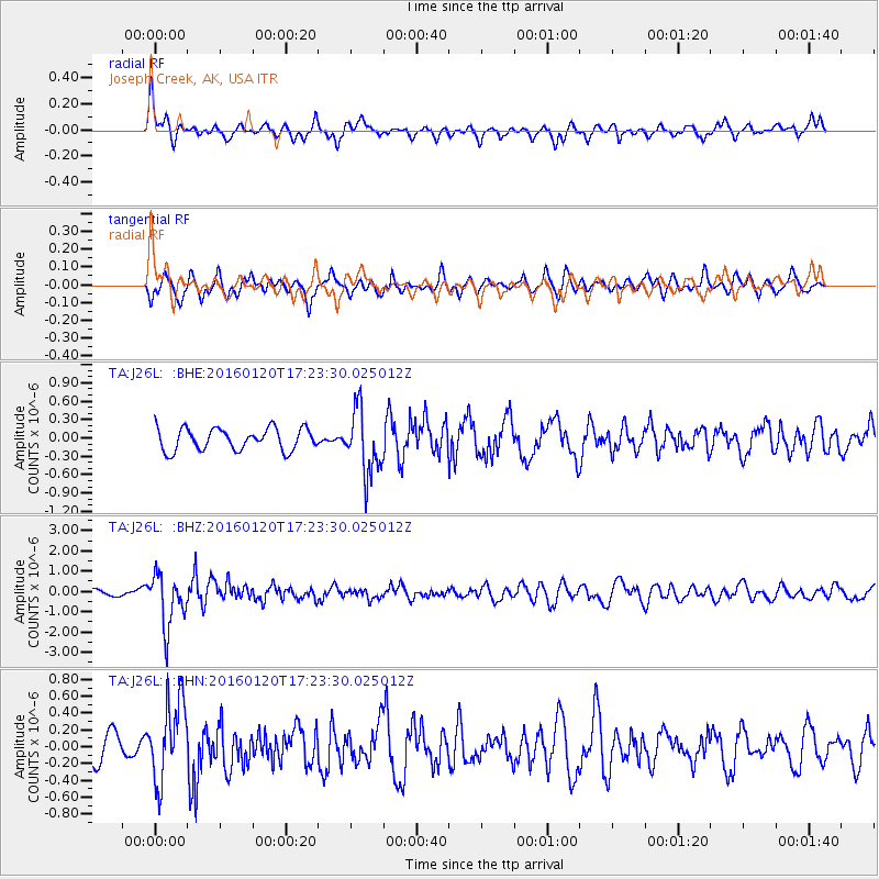
J26L Joseph Creek, AK, USA - Earthquake Result Viewer
*The percent match for this event was below the threshold and hence no stack was calculated.
| Earthquake location: |
Qinghai, China |
| Earthquake latitude/longitude: |
37.7/101.6 |
| Earthquake time(UTC): |
2016/01/20 (020) 17:13:14 GMT |
| Earthquake Depth: |
10 km |
| Earthquake Magnitude: |
5.9 MWB |
| Earthquake Catalog/Contributor: |
NEIC PDE/NEIC COMCAT |
|
| Network: |
TA USArray Transportable Network (new EarthScope stations) |
| Station: |
J26L Joseph Creek, AK, USA |
| Lat/Lon: |
64.50 N/143.56 W |
| Elevation: |
1144 m |
|
| Distance: |
66.1 deg |
| Az: |
25.44 deg |
| Baz: |
308.097 deg |
| Ray Param: |
$rayparam |
*The percent match for this event was below the threshold and hence was not used in the summary stack. |
|
| Radial Match: |
61.614147 % |
| Radial Bump: |
400 |
| Transverse Match: |
51.027916 % |
| Transverse Bump: |
390 |
| SOD ConfigId: |
7422571 |
| Insert Time: |
2019-04-21 19:02:40.641 +0000 |
| GWidth: |
2.5 |
| Max Bumps: |
400 |
| Tol: |
0.001 |
|
Signal To Noise
| Channel | StoN | STA | LTA |
| TA:J26L: :BHZ:20160120T17:23:30.025012Z | 10.302228 | 1.2751607E-6 | 1.2377524E-7 |
| TA:J26L: :BHN:20160120T17:23:30.025012Z | 2.706744 | 4.7539027E-7 | 1.7563178E-7 |
| TA:J26L: :BHE:20160120T17:23:30.025012Z | 3.0096543 | 5.2364294E-7 | 1.7398774E-7 |
| Arrivals |
| Ps | |
| PpPs | |
| PsPs/PpSs | |


