You are here: Home > Network List > US - United States National Seismic Network Stations List
> Station DGMT Dagmar, Montana, USA > Earthquake Result Viewer
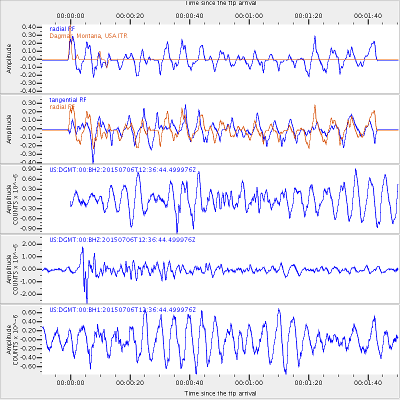
DGMT Dagmar, Montana, USA - Earthquake Result Viewer
*The percent match for this event was below the threshold and hence no stack was calculated.
| Earthquake location: |
Tonga Islands |
| Earthquake latitude/longitude: |
-20.8/-174.5 |
| Earthquake time(UTC): |
2015/07/06 (187) 12:24:00 GMT |
| Earthquake Depth: |
1.0 km |
| Earthquake Magnitude: |
6.2 MO |
| Earthquake Catalog/Contributor: |
NEIC PDE/NEIC ALERT |
|
| Network: |
US United States National Seismic Network |
| Station: |
DGMT Dagmar, Montana, USA |
| Lat/Lon: |
48.47 N/104.20 W |
| Elevation: |
0.0 m |
|
| Distance: |
93.0 deg |
| Az: |
38.856 deg |
| Baz: |
241.894 deg |
| Ray Param: |
$rayparam |
*The percent match for this event was below the threshold and hence was not used in the summary stack. |
|
| Radial Match: |
64.78258 % |
| Radial Bump: |
400 |
| Transverse Match: |
70.17964 % |
| Transverse Bump: |
400 |
| SOD ConfigId: |
976571 |
| Insert Time: |
2015-07-20 12:51:57.144 +0000 |
| GWidth: |
2.5 |
| Max Bumps: |
400 |
| Tol: |
0.001 |
|
Signal To Noise
| Channel | StoN | STA | LTA |
| US:DGMT:00:BHZ:20150706T12:36:44.499976Z | 4.9667573 | 7.173902E-7 | 1.4443835E-7 |
| US:DGMT:00:BH1:20150706T12:36:44.499976Z | 0.58625066 | 2.2439421E-7 | 3.8276156E-7 |
| US:DGMT:00:BH2:20150706T12:36:44.499976Z | 0.7344008 | 2.3228186E-7 | 3.162876E-7 |
| Arrivals |
| Ps | |
| PpPs | |
| PsPs/PpSs | |


