You are here: Home > Network List > TA - USArray Transportable Network (new EarthScope stations) Stations List
> Station A21K Barrow, AK, USA > Earthquake Result Viewer
A21K Barrow, AK, USA - Earthquake Result Viewer

| Earthquake location: |
Off Coast Of Jalisco, Mexico |
| Earthquake latitude/longitude: |
18.8/-107.0 |
| Earthquake time(UTC): |
2016/01/21 (021) 18:06:59 GMT |
| Earthquake Depth: |
10 km |
| Earthquake Magnitude: |
6.6 MWW, 6.9 MI |
| Earthquake Catalog/Contributor: |
NEIC PDE/NEIC COMCAT |
|
| Network: |
TA USArray Transportable Network (new EarthScope stations) |
| Station: |
A21K Barrow, AK, USA |
| Lat/Lon: |
71.32 N/156.62 W |
| Elevation: |
577 m |
|
| Distance: |
59.9 deg |
| Az: |
343.51 deg |
| Baz: |
123.449 deg |
| Ray Param: |
0.061880462 |
| Estimated Moho Depth: |
19.0 km |
| Estimated Crust Vp/Vs: |
2.10 |
| Assumed Crust Vp: |
6.048 km/s |
| Estimated Crust Vs: |
2.883 km/s |
| Estimated Crust Poisson's Ratio: |
0.35 |
|
| Radial Match: |
86.58585 % |
| Radial Bump: |
400 |
| Transverse Match: |
67.15281 % |
| Transverse Bump: |
400 |
| SOD ConfigId: |
7422571 |
| Insert Time: |
2019-04-21 19:16:29.814 +0000 |
| GWidth: |
2.5 |
| Max Bumps: |
400 |
| Tol: |
0.001 |
|
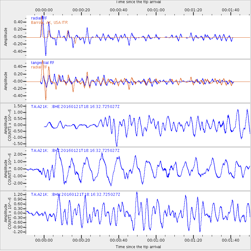
Signal To Noise
| Channel | StoN | STA | LTA |
| TA:A21K: :BHZ:20160121T18:16:32.725027Z | 5.969765 | 6.871107E-7 | 1.1509844E-7 |
| TA:A21K: :BHN:20160121T18:16:32.725027Z | 1.1748785 | 1.914794E-7 | 1.6297805E-7 |
| TA:A21K: :BHE:20160121T18:16:32.725027Z | 3.190029 | 4.1048594E-7 | 1.2867781E-7 |
| Arrivals |
| Ps | 3.6 SECOND |
| PpPs | 9.4 SECOND |
| PsPs/PpSs | 13 SECOND |


