You are here: Home > Network List > UW - Pacific Northwest Regional Seismic Network Stations List
> Station LEBA Lebam, WA, USA > Earthquake Result Viewer
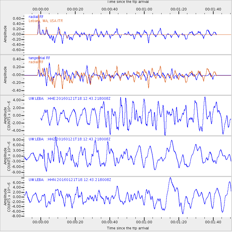
LEBA Lebam, WA, USA - Earthquake Result Viewer
*The percent match for this event was below the threshold and hence no stack was calculated.
| Earthquake location: |
Off Coast Of Jalisco, Mexico |
| Earthquake latitude/longitude: |
18.8/-107.0 |
| Earthquake time(UTC): |
2016/01/21 (021) 18:06:59 GMT |
| Earthquake Depth: |
10 km |
| Earthquake Magnitude: |
6.6 MWW, 6.9 MI |
| Earthquake Catalog/Contributor: |
NEIC PDE/NEIC COMCAT |
|
| Network: |
UW Pacific Northwest Regional Seismic Network |
| Station: |
LEBA Lebam, WA, USA |
| Lat/Lon: |
46.55 N/123.56 W |
| Elevation: |
73 m |
|
| Distance: |
30.8 deg |
| Az: |
337.358 deg |
| Baz: |
148.113 deg |
| Ray Param: |
$rayparam |
*The percent match for this event was below the threshold and hence was not used in the summary stack. |
|
| Radial Match: |
75.38147 % |
| Radial Bump: |
400 |
| Transverse Match: |
63.14841 % |
| Transverse Bump: |
400 |
| SOD ConfigId: |
7422571 |
| Insert Time: |
2019-04-21 19:17:14.874 +0000 |
| GWidth: |
2.5 |
| Max Bumps: |
400 |
| Tol: |
0.001 |
|
Signal To Noise
| Channel | StoN | STA | LTA |
| UW:LEBA: :HHZ:20160121T18:12:43.218008Z | 3.4636817 | 3.5319863E-6 | 1.0197202E-6 |
| UW:LEBA: :HHN:20160121T18:12:43.218008Z | 1.5175612 | 2.0328218E-6 | 1.339532E-6 |
| UW:LEBA: :HHE:20160121T18:12:43.218008Z | 1.4045436 | 1.8493431E-6 | 1.3166862E-6 |
| Arrivals |
| Ps | |
| PpPs | |
| PsPs/PpSs | |


