You are here: Home > Network List > CN - Canadian National Seismograph Network Stations List
> Station INK INUVIK, NT > Earthquake Result Viewer
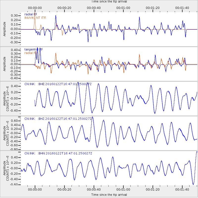
INK INUVIK, NT - Earthquake Result Viewer
*The percent match for this event was below the threshold and hence no stack was calculated.
| Earthquake location: |
Vanuatu Islands Region |
| Earthquake latitude/longitude: |
-13.7/172.1 |
| Earthquake time(UTC): |
2016/01/22 (022) 16:34:35 GMT |
| Earthquake Depth: |
44 km |
| Earthquake Magnitude: |
5.6 MWW, 5.5 MWC |
| Earthquake Catalog/Contributor: |
NEIC PDE/NEIC COMCAT |
|
| Network: |
CN Canadian National Seismograph Network |
| Station: |
INK INUVIK, NT |
| Lat/Lon: |
68.31 N/133.53 W |
| Elevation: |
44 m |
|
| Distance: |
90.5 deg |
| Az: |
17.6 deg |
| Baz: |
232.22 deg |
| Ray Param: |
$rayparam |
*The percent match for this event was below the threshold and hence was not used in the summary stack. |
|
| Radial Match: |
59.059372 % |
| Radial Bump: |
400 |
| Transverse Match: |
50.17576 % |
| Transverse Bump: |
400 |
| SOD ConfigId: |
7422571 |
| Insert Time: |
2019-04-21 19:20:48.853 +0000 |
| GWidth: |
2.5 |
| Max Bumps: |
400 |
| Tol: |
0.001 |
|
Signal To Noise
| Channel | StoN | STA | LTA |
| CN:INK: :BHZ:20160122T16:47:01.250027Z | 0.5781753 | 1.3089918E-7 | 2.2640052E-7 |
| CN:INK: :BHN:20160122T16:47:01.250027Z | 1.8683171 | 2.0001445E-7 | 1.0705594E-7 |
| CN:INK: :BHE:20160122T16:47:01.250027Z | 1.8513173 | 3.5727197E-7 | 1.9298257E-7 |
| Arrivals |
| Ps | |
| PpPs | |
| PsPs/PpSs | |


