You are here: Home > Network List > TA - USArray Transportable Network (new EarthScope stations) Stations List
> Station 121A Cookes Peak, Deming, NM, USA > Earthquake Result Viewer
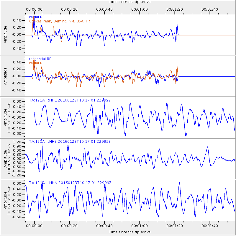
121A Cookes Peak, Deming, NM, USA - Earthquake Result Viewer
*The percent match for this event was below the threshold and hence no stack was calculated.
| Earthquake location: |
Easter Island Region |
| Earthquake latitude/longitude: |
-22.4/-114.0 |
| Earthquake time(UTC): |
2016/01/23 (023) 10:08:01 GMT |
| Earthquake Depth: |
10 km |
| Earthquake Magnitude: |
5.5 MB |
| Earthquake Catalog/Contributor: |
NEIC PDE/NEIC COMCAT |
|
| Network: |
TA USArray Transportable Network (new EarthScope stations) |
| Station: |
121A Cookes Peak, Deming, NM, USA |
| Lat/Lon: |
32.53 N/107.79 W |
| Elevation: |
1652 m |
|
| Distance: |
54.9 deg |
| Az: |
6.382 deg |
| Baz: |
186.995 deg |
| Ray Param: |
$rayparam |
*The percent match for this event was below the threshold and hence was not used in the summary stack. |
|
| Radial Match: |
58.95609 % |
| Radial Bump: |
400 |
| Transverse Match: |
57.396595 % |
| Transverse Bump: |
389 |
| SOD ConfigId: |
7422571 |
| Insert Time: |
2019-04-21 19:35:33.067 +0000 |
| GWidth: |
2.5 |
| Max Bumps: |
400 |
| Tol: |
0.001 |
|
Signal To Noise
| Channel | StoN | STA | LTA |
| TA:121A: :HHZ:20160123T10:17:01.22999Z | 2.9708633 | 5.9874134E-7 | 2.0153782E-7 |
| TA:121A: :HHN:20160123T10:17:01.22999Z | 1.4852428 | 3.2370824E-7 | 2.179497E-7 |
| TA:121A: :HHE:20160123T10:17:01.22999Z | 1.1374938 | 2.5310558E-7 | 2.225116E-7 |
| Arrivals |
| Ps | |
| PpPs | |
| PsPs/PpSs | |


