You are here: Home > Network List > TA - USArray Transportable Network (new EarthScope stations) Stations List
> Station T25A Trinidad, CO, USA > Earthquake Result Viewer
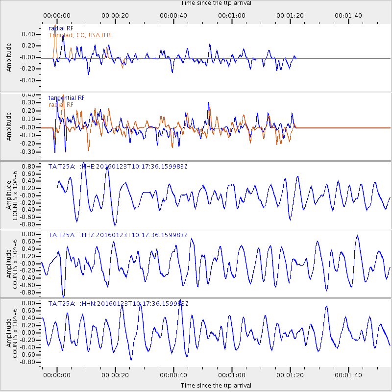
T25A Trinidad, CO, USA - Earthquake Result Viewer
*The percent match for this event was below the threshold and hence no stack was calculated.
| Earthquake location: |
Easter Island Region |
| Earthquake latitude/longitude: |
-22.4/-114.0 |
| Earthquake time(UTC): |
2016/01/23 (023) 10:08:01 GMT |
| Earthquake Depth: |
10 km |
| Earthquake Magnitude: |
5.5 MB |
| Earthquake Catalog/Contributor: |
NEIC PDE/NEIC COMCAT |
|
| Network: |
TA USArray Transportable Network (new EarthScope stations) |
| Station: |
T25A Trinidad, CO, USA |
| Lat/Lon: |
37.14 N/104.41 W |
| Elevation: |
2017 m |
|
| Distance: |
59.9 deg |
| Az: |
8.822 deg |
| Baz: |
190.232 deg |
| Ray Param: |
$rayparam |
*The percent match for this event was below the threshold and hence was not used in the summary stack. |
|
| Radial Match: |
60.391033 % |
| Radial Bump: |
400 |
| Transverse Match: |
61.548443 % |
| Transverse Bump: |
400 |
| SOD ConfigId: |
7422571 |
| Insert Time: |
2019-04-21 19:35:55.672 +0000 |
| GWidth: |
2.5 |
| Max Bumps: |
400 |
| Tol: |
0.001 |
|
Signal To Noise
| Channel | StoN | STA | LTA |
| TA:T25A: :HHZ:20160123T10:17:36.159983Z | 1.736916 | 4.338715E-7 | 2.4979417E-7 |
| TA:T25A: :HHN:20160123T10:17:36.159983Z | 1.7790734 | 3.0556347E-7 | 1.7175428E-7 |
| TA:T25A: :HHE:20160123T10:17:36.159983Z | 0.39291057 | 1.6354433E-7 | 4.1623804E-7 |
| Arrivals |
| Ps | |
| PpPs | |
| PsPs/PpSs | |


