You are here: Home > Network List > IC - New China Digital Seismograph Network Stations List
> Station QIZ Qiongzhong, Guangduong Province, China > Earthquake Result Viewer
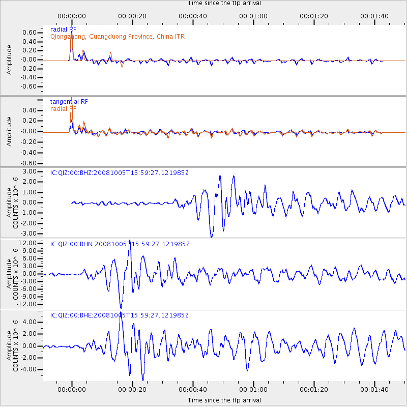
QIZ Qiongzhong, Guangduong Province, China - Earthquake Result Viewer

| Earthquake location: |
Tajikistan-Xinjiang Border Reg. |
| Earthquake latitude/longitude: |
39.5/73.8 |
| Earthquake time(UTC): |
2008/10/05 (279) 15:52:49 GMT |
| Earthquake Depth: |
27 km |
| Earthquake Magnitude: |
6.4 MB, 6.9 MS, 6.6 MW, 6.6 MW |
| Earthquake Catalog/Contributor: |
WHDF/NEIC |
|
| Network: |
IC New China Digital Seismograph Network |
| Station: |
QIZ Qiongzhong, Guangduong Province, China |
| Lat/Lon: |
19.03 N/109.84 E |
| Elevation: |
230 m |
|
| Distance: |
37.1 deg |
| Az: |
112.852 deg |
| Baz: |
311.122 deg |
| Ray Param: |
0.07625555 |
| Estimated Moho Depth: |
29.75 km |
| Estimated Crust Vp/Vs: |
1.82 |
| Assumed Crust Vp: |
6.182 km/s |
| Estimated Crust Vs: |
3.402 km/s |
| Estimated Crust Poisson's Ratio: |
0.28 |
|
| Radial Match: |
93.90585 % |
| Radial Bump: |
249 |
| Transverse Match: |
84.25987 % |
| Transverse Bump: |
400 |
| SOD ConfigId: |
2556 |
| Insert Time: |
2010-03-04 23:31:27.891 +0000 |
| GWidth: |
2.5 |
| Max Bumps: |
400 |
| Tol: |
0.001 |
|
Signal To Noise
| Channel | StoN | STA | LTA |
| IC:QIZ:00:BHN:20081005T15:59:27.121985Z | 2.7561808 | 6.393301E-7 | 2.3196233E-7 |
| IC:QIZ:00:BHE:20081005T15:59:27.121985Z | 2.0170147 | 2.656236E-7 | 1.3169146E-7 |
| IC:QIZ:00:BHZ:20081005T15:59:27.121985Z | 1.8185022 | 1.4960213E-7 | 8.226668E-8 |
| Arrivals |
| Ps | 4.2 SECOND |
| PpPs | 13 SECOND |
| PsPs/PpSs | 17 SECOND |


