You are here: Home > Network List > CI - Caltech Regional Seismic Network Stations List
> Station SMM Simmler, CA, USA > Earthquake Result Viewer
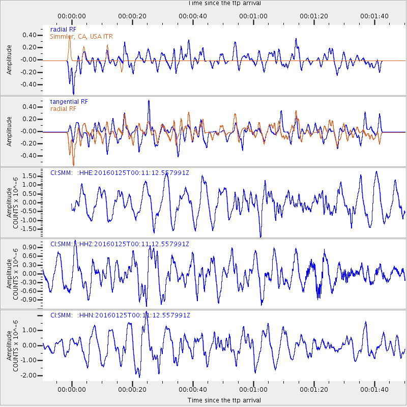
SMM Simmler, CA, USA - Earthquake Result Viewer
*The percent match for this event was below the threshold and hence no stack was calculated.
| Earthquake location: |
Tonga Islands |
| Earthquake latitude/longitude: |
-19.6/-173.4 |
| Earthquake time(UTC): |
2016/01/25 (025) 00:00:09 GMT |
| Earthquake Depth: |
40 km |
| Earthquake Magnitude: |
5.7 MB |
| Earthquake Catalog/Contributor: |
NEIC PDE/NEIC COMCAT |
|
| Network: |
CI Caltech Regional Seismic Network |
| Station: |
SMM Simmler, CA, USA |
| Lat/Lon: |
35.31 N/120.00 W |
| Elevation: |
599 m |
|
| Distance: |
74.5 deg |
| Az: |
42.959 deg |
| Baz: |
231.777 deg |
| Ray Param: |
$rayparam |
*The percent match for this event was below the threshold and hence was not used in the summary stack. |
|
| Radial Match: |
44.894455 % |
| Radial Bump: |
400 |
| Transverse Match: |
56.55159 % |
| Transverse Bump: |
400 |
| SOD ConfigId: |
7422571 |
| Insert Time: |
2019-04-21 19:51:01.951 +0000 |
| GWidth: |
2.5 |
| Max Bumps: |
400 |
| Tol: |
0.001 |
|
Signal To Noise
| Channel | StoN | STA | LTA |
| CI:SMM: :HHZ:20160125T00:11:12.557991Z | 1.4521576 | 5.363596E-7 | 3.6935356E-7 |
| CI:SMM: :HHN:20160125T00:11:12.557991Z | 1.4782789 | 4.7990426E-7 | 3.2463717E-7 |
| CI:SMM: :HHE:20160125T00:11:12.557991Z | 1.7337501 | 1.0570126E-6 | 6.096684E-7 |
| Arrivals |
| Ps | |
| PpPs | |
| PsPs/PpSs | |


