You are here: Home > Network List > IU - Global Seismograph Network (GSN - IRIS/USGS) Stations List
> Station XMAS Kiritimati Island, Republic of Kiribati > Earthquake Result Viewer
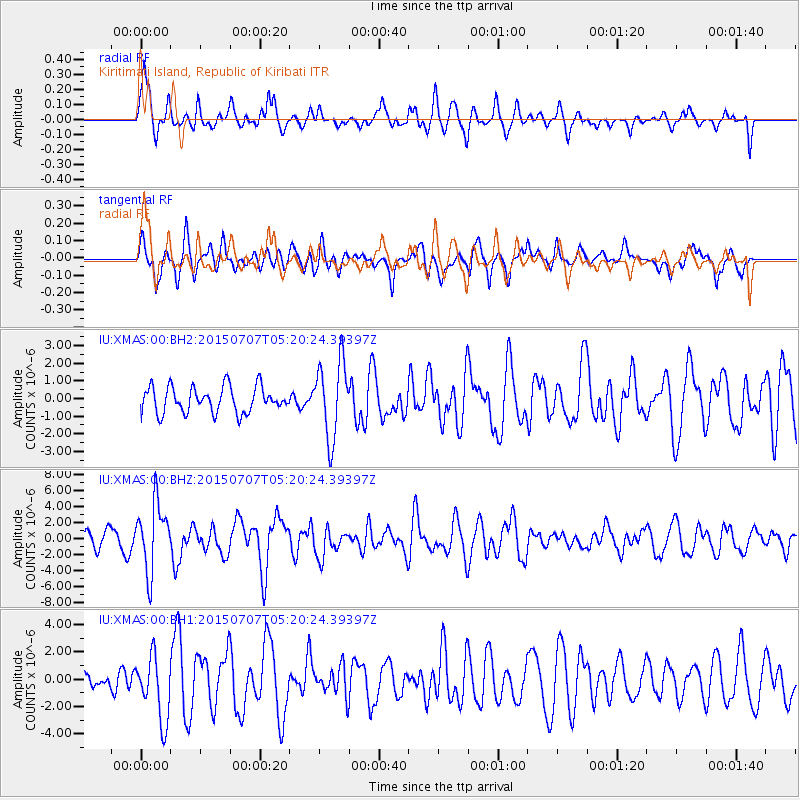
XMAS Kiritimati Island, Republic of Kiribati - Earthquake Result Viewer
*The percent match for this event was below the threshold and hence no stack was calculated.
| Earthquake location: |
Kuril Islands |
| Earthquake latitude/longitude: |
44.0/147.9 |
| Earthquake time(UTC): |
2015/07/07 (188) 05:10:27 GMT |
| Earthquake Depth: |
38 km |
| Earthquake Magnitude: |
6.3 MO |
| Earthquake Catalog/Contributor: |
NEIC PDE/NEIC ALERT |
|
| Network: |
IU Global Seismograph Network (GSN - IRIS/USGS) |
| Station: |
XMAS Kiritimati Island, Republic of Kiribati |
| Lat/Lon: |
2.04 N/157.45 W |
| Elevation: |
20 m |
|
| Distance: |
63.8 deg |
| Az: |
114.707 deg |
| Baz: |
318.992 deg |
| Ray Param: |
$rayparam |
*The percent match for this event was below the threshold and hence was not used in the summary stack. |
|
| Radial Match: |
64.5084 % |
| Radial Bump: |
400 |
| Transverse Match: |
52.65531 % |
| Transverse Bump: |
398 |
| SOD ConfigId: |
976571 |
| Insert Time: |
2015-07-21 05:32:55.331 +0000 |
| GWidth: |
2.5 |
| Max Bumps: |
400 |
| Tol: |
0.001 |
|
Signal To Noise
| Channel | StoN | STA | LTA |
| IU:XMAS:00:BHZ:20150707T05:20:24.39397Z | 3.3327203 | 4.231607E-6 | 1.2697155E-6 |
| IU:XMAS:00:BH1:20150707T05:20:24.39397Z | 1.8008945 | 2.3456146E-6 | 1.302472E-6 |
| IU:XMAS:00:BH2:20150707T05:20:24.39397Z | 2.9468646 | 2.1598337E-6 | 7.32926E-7 |
| Arrivals |
| Ps | |
| PpPs | |
| PsPs/PpSs | |


