You are here: Home > Network List > TA - USArray Transportable Network (new EarthScope stations) Stations List
> Station MSTX Muleshoe, TX, USA > Earthquake Result Viewer
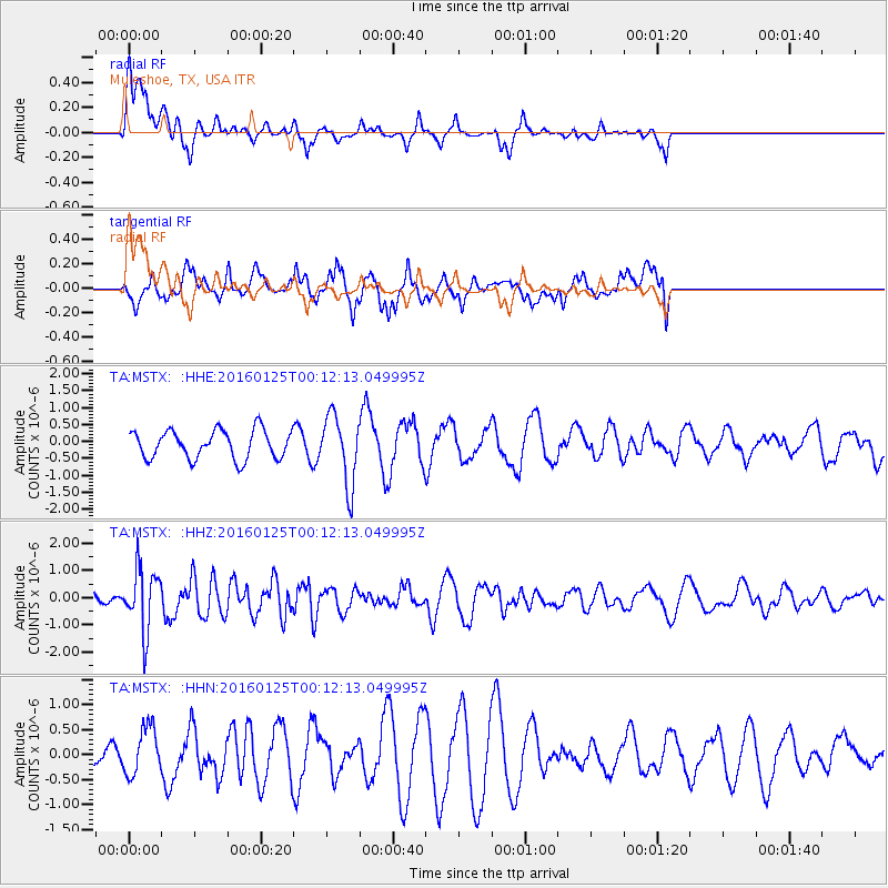
MSTX Muleshoe, TX, USA - Earthquake Result Viewer
*The percent match for this event was below the threshold and hence no stack was calculated.
| Earthquake location: |
Tonga Islands |
| Earthquake latitude/longitude: |
-19.6/-173.4 |
| Earthquake time(UTC): |
2016/01/25 (025) 00:00:09 GMT |
| Earthquake Depth: |
40 km |
| Earthquake Magnitude: |
5.7 MB |
| Earthquake Catalog/Contributor: |
NEIC PDE/NEIC COMCAT |
|
| Network: |
TA USArray Transportable Network (new EarthScope stations) |
| Station: |
MSTX Muleshoe, TX, USA |
| Lat/Lon: |
33.97 N/102.77 W |
| Elevation: |
1167 m |
|
| Distance: |
85.7 deg |
| Az: |
51.831 deg |
| Baz: |
243.11 deg |
| Ray Param: |
$rayparam |
*The percent match for this event was below the threshold and hence was not used in the summary stack. |
|
| Radial Match: |
55.049786 % |
| Radial Bump: |
400 |
| Transverse Match: |
54.73639 % |
| Transverse Bump: |
400 |
| SOD ConfigId: |
7422571 |
| Insert Time: |
2019-04-21 19:54:35.027 +0000 |
| GWidth: |
2.5 |
| Max Bumps: |
400 |
| Tol: |
0.001 |
|
Signal To Noise
| Channel | StoN | STA | LTA |
| TA:MSTX: :HHZ:20160125T00:12:13.049995Z | 3.3723676 | 1.1290964E-6 | 3.3480822E-7 |
| TA:MSTX: :HHN:20160125T00:12:13.049995Z | 0.6642909 | 4.8037066E-7 | 7.231329E-7 |
| TA:MSTX: :HHE:20160125T00:12:13.049995Z | 2.47335 | 1.0509619E-6 | 4.249144E-7 |
| Arrivals |
| Ps | |
| PpPs | |
| PsPs/PpSs | |


