You are here: Home > Network List > IW - Intermountain West Stations List
> Station PLID Pearl Lake, Idaho, USA > Earthquake Result Viewer
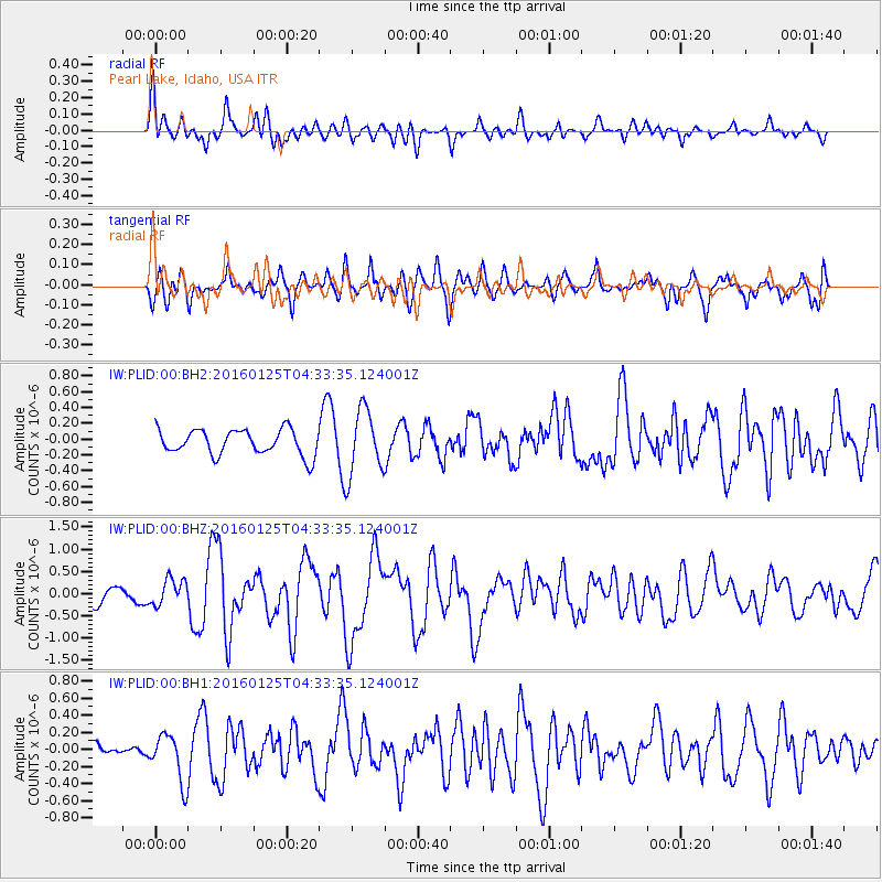
PLID Pearl Lake, Idaho, USA - Earthquake Result Viewer
*The percent match for this event was below the threshold and hence no stack was calculated.
| Earthquake location: |
Strait Of Gibraltar |
| Earthquake latitude/longitude: |
35.7/-3.6 |
| Earthquake time(UTC): |
2016/01/25 (025) 04:22:02 GMT |
| Earthquake Depth: |
10 km |
| Earthquake Magnitude: |
6.1 MWP |
| Earthquake Catalog/Contributor: |
NEIC PDE/NEIC COMCAT |
|
| Network: |
IW Intermountain West |
| Station: |
PLID Pearl Lake, Idaho, USA |
| Lat/Lon: |
45.09 N/116.00 W |
| Elevation: |
2164 m |
|
| Distance: |
79.0 deg |
| Az: |
318.149 deg |
| Baz: |
50.014 deg |
| Ray Param: |
$rayparam |
*The percent match for this event was below the threshold and hence was not used in the summary stack. |
|
| Radial Match: |
70.11671 % |
| Radial Bump: |
400 |
| Transverse Match: |
76.553154 % |
| Transverse Bump: |
400 |
| SOD ConfigId: |
7422571 |
| Insert Time: |
2019-04-21 19:59:56.282 +0000 |
| GWidth: |
2.5 |
| Max Bumps: |
400 |
| Tol: |
0.001 |
|
Signal To Noise
| Channel | StoN | STA | LTA |
| IW:PLID:00:BHZ:20160125T04:33:35.124001Z | 1.2725883 | 2.9092743E-7 | 2.2861082E-7 |
| IW:PLID:00:BH1:20160125T04:33:35.124001Z | 2.0292504 | 2.797315E-7 | 1.3784967E-7 |
| IW:PLID:00:BH2:20160125T04:33:35.124001Z | 2.390111 | 3.8168483E-7 | 1.5969336E-7 |
| Arrivals |
| Ps | |
| PpPs | |
| PsPs/PpSs | |


