You are here: Home > Network List > TA - USArray Transportable Network (new EarthScope stations) Stations List
> Station X43A Marvell, AR, USA > Earthquake Result Viewer
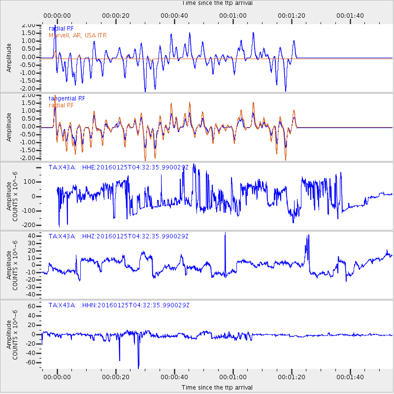
X43A Marvell, AR, USA - Earthquake Result Viewer
*The percent match for this event was below the threshold and hence no stack was calculated.
| Earthquake location: |
Strait Of Gibraltar |
| Earthquake latitude/longitude: |
35.7/-3.6 |
| Earthquake time(UTC): |
2016/01/25 (025) 04:22:02 GMT |
| Earthquake Depth: |
10 km |
| Earthquake Magnitude: |
6.1 MWP |
| Earthquake Catalog/Contributor: |
NEIC PDE/NEIC COMCAT |
|
| Network: |
TA USArray Transportable Network (new EarthScope stations) |
| Station: |
X43A Marvell, AR, USA |
| Lat/Lon: |
34.52 N/90.88 W |
| Elevation: |
53 m |
|
| Distance: |
68.9 deg |
| Az: |
297.869 deg |
| Baz: |
60.57 deg |
| Ray Param: |
$rayparam |
*The percent match for this event was below the threshold and hence was not used in the summary stack. |
|
| Radial Match: |
51.840805 % |
| Radial Bump: |
400 |
| Transverse Match: |
52.566116 % |
| Transverse Bump: |
400 |
| SOD ConfigId: |
7422571 |
| Insert Time: |
2019-04-21 20:03:48.388 +0000 |
| GWidth: |
2.5 |
| Max Bumps: |
400 |
| Tol: |
0.001 |
|
Signal To Noise
| Channel | StoN | STA | LTA |
| TA:X43A: :HHZ:20160125T04:32:35.990029Z | 0.7782131 | 8.744866E-6 | 1.123711E-5 |
| TA:X43A: :HHN:20160125T04:32:35.990029Z | 0.9593728 | 3.4583638E-6 | 3.6048173E-6 |
| TA:X43A: :HHE:20160125T04:32:35.990029Z | 1.3987479 | 8.093539E-5 | 5.7862737E-5 |
| Arrivals |
| Ps | |
| PpPs | |
| PsPs/PpSs | |


