You are here: Home > Network List > TA - USArray Transportable Network (new EarthScope stations) Stations List
> Station L04D Klamath Falls, OR, USA > Earthquake Result Viewer
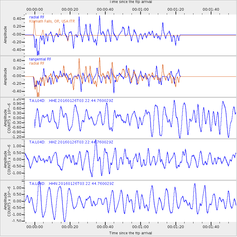
L04D Klamath Falls, OR, USA - Earthquake Result Viewer
*The percent match for this event was below the threshold and hence no stack was calculated.
| Earthquake location: |
New Ireland Region, P.N.G. |
| Earthquake latitude/longitude: |
-5.3/153.2 |
| Earthquake time(UTC): |
2016/01/26 (026) 03:10:23 GMT |
| Earthquake Depth: |
44 km |
| Earthquake Magnitude: |
5.8 MWP |
| Earthquake Catalog/Contributor: |
NEIC PDE/NEIC COMCAT |
|
| Network: |
TA USArray Transportable Network (new EarthScope stations) |
| Station: |
L04D Klamath Falls, OR, USA |
| Lat/Lon: |
42.22 N/122.30 W |
| Elevation: |
1437 m |
|
| Distance: |
89.5 deg |
| Az: |
47.687 deg |
| Baz: |
262.407 deg |
| Ray Param: |
$rayparam |
*The percent match for this event was below the threshold and hence was not used in the summary stack. |
|
| Radial Match: |
65.79474 % |
| Radial Bump: |
400 |
| Transverse Match: |
40.41529 % |
| Transverse Bump: |
363 |
| SOD ConfigId: |
7422571 |
| Insert Time: |
2019-04-21 20:14:41.737 +0000 |
| GWidth: |
2.5 |
| Max Bumps: |
400 |
| Tol: |
0.001 |
|
Signal To Noise
| Channel | StoN | STA | LTA |
| TA:L04D: :HHZ:20160126T03:22:44.760029Z | 0.30058622 | 1.4878805E-7 | 4.9499295E-7 |
| TA:L04D: :HHN:20160126T03:22:44.760029Z | 2.1223018 | 8.757903E-7 | 4.126606E-7 |
| TA:L04D: :HHE:20160126T03:22:44.760029Z | 0.7421277 | 3.0605673E-7 | 4.1240438E-7 |
| Arrivals |
| Ps | |
| PpPs | |
| PsPs/PpSs | |


