You are here: Home > Network List > UU - University of Utah Regional Network Stations List
> Station FORU South Mineral Mountains, UT, USA > Earthquake Result Viewer
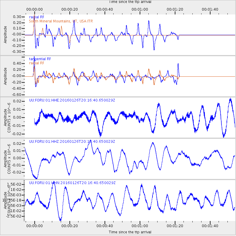
FORU South Mineral Mountains, UT, USA - Earthquake Result Viewer
*The percent match for this event was below the threshold and hence no stack was calculated.
| Earthquake location: |
New Ireland Region, P.N.G. |
| Earthquake latitude/longitude: |
-5.3/153.2 |
| Earthquake time(UTC): |
2016/01/26 (026) 20:03:43 GMT |
| Earthquake Depth: |
10 km |
| Earthquake Magnitude: |
5.3 mwb |
| Earthquake Catalog/Contributor: |
NEIC PDE/us |
|
| Network: |
UU University of Utah Regional Network |
| Station: |
FORU South Mineral Mountains, UT, USA |
| Lat/Lon: |
38.46 N/112.86 W |
| Elevation: |
1840 m |
|
| Distance: |
96.3 deg |
| Az: |
52.002 deg |
| Baz: |
268.316 deg |
| Ray Param: |
$rayparam |
*The percent match for this event was below the threshold and hence was not used in the summary stack. |
|
| Radial Match: |
54.321854 % |
| Radial Bump: |
363 |
| Transverse Match: |
54.69334 % |
| Transverse Bump: |
400 |
| SOD ConfigId: |
7422571 |
| Insert Time: |
2019-04-21 20:21:11.317 +0000 |
| GWidth: |
2.5 |
| Max Bumps: |
400 |
| Tol: |
0.001 |
|
Signal To Noise
| Channel | StoN | STA | LTA |
| UU:FORU:01:HHZ:20160126T20:16:40.650029Z | 1.4324158 | 2.3465837E-8 | 1.6382002E-8 |
| UU:FORU:01:HHN:20160126T20:16:40.650029Z | 0.5253208 | 3.9087245E-9 | 7.4406423E-9 |
| UU:FORU:01:HHE:20160126T20:16:40.650029Z | 1.1848832 | 4.753654E-9 | 4.011918E-9 |
| Arrivals |
| Ps | |
| PpPs | |
| PsPs/PpSs | |


