You are here: Home > Network List > CN - Canadian National Seismograph Network Stations List
> Station INK INUVIK, NT > Earthquake Result Viewer
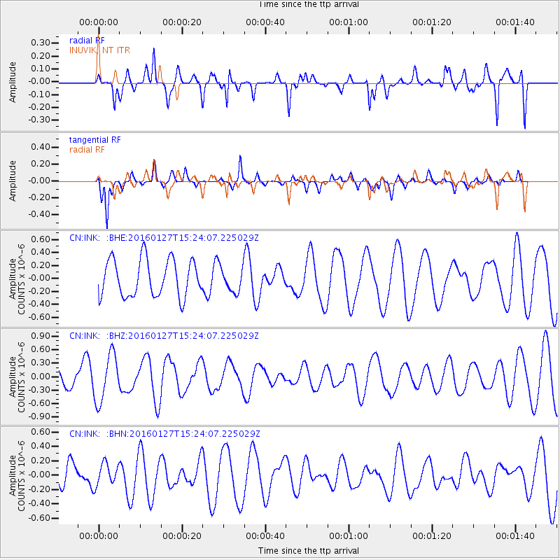
INK INUVIK, NT - Earthquake Result Viewer
*The percent match for this event was below the threshold and hence no stack was calculated.
| Earthquake location: |
Central Mid-Atlantic Ridge |
| Earthquake latitude/longitude: |
1.0/-28.1 |
| Earthquake time(UTC): |
2016/01/27 (027) 15:11:17 GMT |
| Earthquake Depth: |
10 km |
| Earthquake Magnitude: |
5.7 mwc |
| Earthquake Catalog/Contributor: |
NEIC PDE/us |
|
| Network: |
CN Canadian National Seismograph Network |
| Station: |
INK INUVIK, NT |
| Lat/Lon: |
68.31 N/133.53 W |
| Elevation: |
44 m |
|
| Distance: |
94.7 deg |
| Az: |
338.919 deg |
| Baz: |
75.302 deg |
| Ray Param: |
$rayparam |
*The percent match for this event was below the threshold and hence was not used in the summary stack. |
|
| Radial Match: |
77.77228 % |
| Radial Bump: |
400 |
| Transverse Match: |
61.531425 % |
| Transverse Bump: |
375 |
| SOD ConfigId: |
7422571 |
| Insert Time: |
2019-04-21 20:25:17.165 +0000 |
| GWidth: |
2.5 |
| Max Bumps: |
400 |
| Tol: |
0.001 |
|
Signal To Noise
| Channel | StoN | STA | LTA |
| CN:INK: :BHZ:20160127T15:24:07.225029Z | 2.2075896 | 5.3786965E-7 | 2.4364567E-7 |
| CN:INK: :BHN:20160127T15:24:07.225029Z | 0.5560087 | 1.4516442E-7 | 2.6108302E-7 |
| CN:INK: :BHE:20160127T15:24:07.225029Z | 0.64649874 | 1.8395227E-7 | 2.8453618E-7 |
| Arrivals |
| Ps | |
| PpPs | |
| PsPs/PpSs | |


