You are here: Home > Network List > TA - USArray Transportable Network (new EarthScope stations) Stations List
> Station X43A Marvell, AR, USA > Earthquake Result Viewer
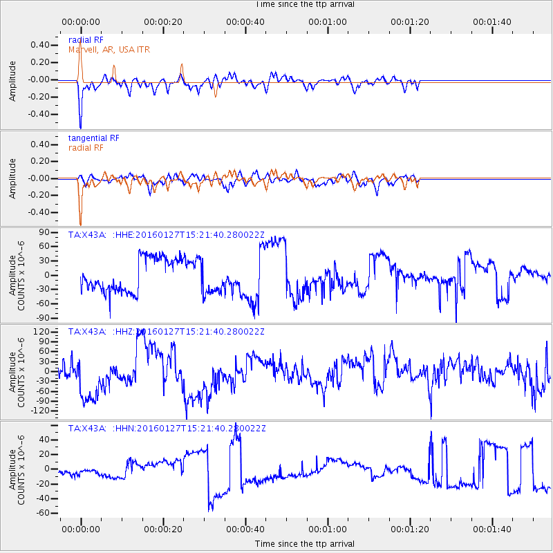
X43A Marvell, AR, USA - Earthquake Result Viewer
*The percent match for this event was below the threshold and hence no stack was calculated.
| Earthquake location: |
Central Mid-Atlantic Ridge |
| Earthquake latitude/longitude: |
1.0/-28.1 |
| Earthquake time(UTC): |
2016/01/27 (027) 15:11:17 GMT |
| Earthquake Depth: |
10 km |
| Earthquake Magnitude: |
5.7 mwc |
| Earthquake Catalog/Contributor: |
NEIC PDE/us |
|
| Network: |
TA USArray Transportable Network (new EarthScope stations) |
| Station: |
X43A Marvell, AR, USA |
| Lat/Lon: |
34.52 N/90.88 W |
| Elevation: |
53 m |
|
| Distance: |
67.2 deg |
| Az: |
307.204 deg |
| Baz: |
105.326 deg |
| Ray Param: |
$rayparam |
*The percent match for this event was below the threshold and hence was not used in the summary stack. |
|
| Radial Match: |
71.25624 % |
| Radial Bump: |
389 |
| Transverse Match: |
53.255825 % |
| Transverse Bump: |
400 |
| SOD ConfigId: |
7422571 |
| Insert Time: |
2019-04-21 20:29:50.302 +0000 |
| GWidth: |
2.5 |
| Max Bumps: |
400 |
| Tol: |
0.001 |
|
Signal To Noise
| Channel | StoN | STA | LTA |
| TA:X43A: :HHZ:20160127T15:21:40.280022Z | 1.7864653 | 8.377094E-5 | 4.6892004E-5 |
| TA:X43A: :HHN:20160127T15:21:40.280022Z | 0.7961962 | 3.7800237E-6 | 4.7476033E-6 |
| TA:X43A: :HHE:20160127T15:21:40.280022Z | 0.99632657 | 3.4281817E-5 | 3.4408215E-5 |
| Arrivals |
| Ps | |
| PpPs | |
| PsPs/PpSs | |


