You are here: Home > Network List > II - Global Seismograph Network (GSN - IRIS/IDA) Stations List
> Station KAPI Kappang, Sulawesi, Indonesia > Earthquake Result Viewer
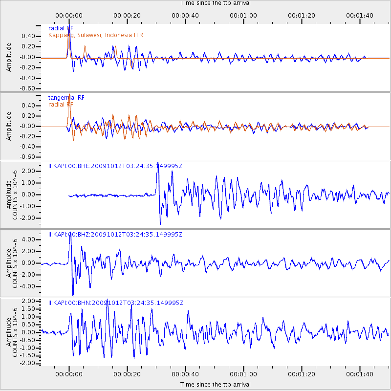
KAPI Kappang, Sulawesi, Indonesia - Earthquake Result Viewer
*The percent match for this event was below the threshold and hence no stack was calculated.
| Earthquake location: |
Mauritius - Reunion Region |
| Earthquake latitude/longitude: |
-17.1/66.7 |
| Earthquake time(UTC): |
2009/10/12 (285) 03:15:47 GMT |
| Earthquake Depth: |
10 km |
| Earthquake Magnitude: |
6.2 MB, 6.0 MS, 6.2 MW, 6.1 MW |
| Earthquake Catalog/Contributor: |
WHDF/NEIC |
|
| Network: |
II Global Seismograph Network (GSN - IRIS/IDA) |
| Station: |
KAPI Kappang, Sulawesi, Indonesia |
| Lat/Lon: |
5.01 S/119.75 E |
| Elevation: |
300 m |
|
| Distance: |
53.3 deg |
| Az: |
83.416 deg |
| Baz: |
252.486 deg |
| Ray Param: |
$rayparam |
*The percent match for this event was below the threshold and hence was not used in the summary stack. |
|
| Radial Match: |
78.01147 % |
| Radial Bump: |
400 |
| Transverse Match: |
85.94758 % |
| Transverse Bump: |
400 |
| SOD ConfigId: |
1 |
| Insert Time: |
2010-02-19 00:42:09.670 +0000 |
| GWidth: |
2.5 |
| Max Bumps: |
400 |
| Tol: |
0.001 |
|
Signal To Noise
| Channel | StoN | STA | LTA |
| II:KAPI:00:BHZ:20091012T03:24:35.149995Z | 25.081839 | 2.637387E-6 | 1.0515127E-7 |
| II:KAPI:00:BHN:20091012T03:24:35.149995Z | 10.565247 | 8.581486E-7 | 8.122371E-8 |
| II:KAPI:00:BHE:20091012T03:24:35.149995Z | 28.570648 | 1.318753E-6 | 4.6157613E-8 |
| Arrivals |
| Ps | |
| PpPs | |
| PsPs/PpSs | |


