You are here: Home > Network List > GS - US Geological Survey Networks Stations List
> Station KAN10 Keim Farm, Anthony, KS, USA > Earthquake Result Viewer
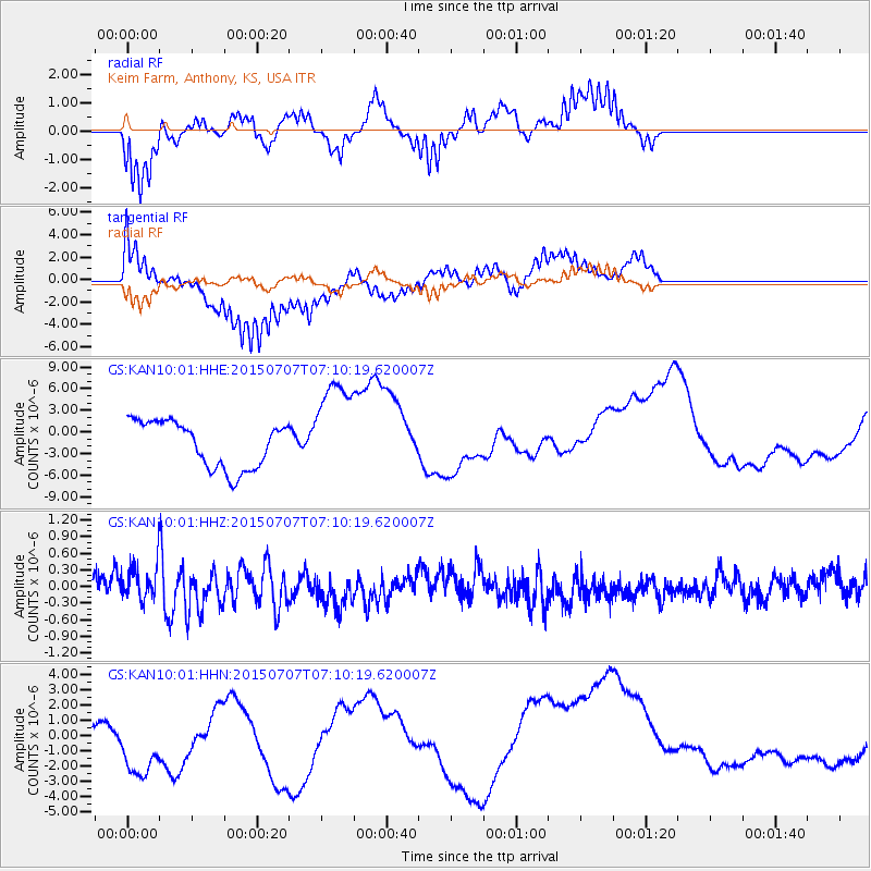
KAN10 Keim Farm, Anthony, KS, USA - Earthquake Result Viewer
*The percent match for this event was below the threshold and hence no stack was calculated.
| Earthquake location: |
Central East Pacific Rise |
| Earthquake latitude/longitude: |
-13.3/-111.6 |
| Earthquake time(UTC): |
2015/07/07 (188) 07:01:44 GMT |
| Earthquake Depth: |
21 km |
| Earthquake Magnitude: |
5.9 MWW, 5.9 MWC |
| Earthquake Catalog/Contributor: |
NEIC PDE/NEIC COMCAT |
|
| Network: |
GS US Geological Survey Networks |
| Station: |
KAN10 Keim Farm, Anthony, KS, USA |
| Lat/Lon: |
37.12 N/98.10 W |
| Elevation: |
417 m |
|
| Distance: |
51.8 deg |
| Az: |
13.784 deg |
| Baz: |
196.869 deg |
| Ray Param: |
$rayparam |
*The percent match for this event was below the threshold and hence was not used in the summary stack. |
|
| Radial Match: |
57.689255 % |
| Radial Bump: |
342 |
| Transverse Match: |
73.66806 % |
| Transverse Bump: |
400 |
| SOD ConfigId: |
976571 |
| Insert Time: |
2015-07-21 07:20:30.547 +0000 |
| GWidth: |
2.5 |
| Max Bumps: |
400 |
| Tol: |
0.001 |
|
Signal To Noise
| Channel | StoN | STA | LTA |
| GS:KAN10:01:HHZ:20150707T07:10:19.620007Z | 1.094134 | 3.100034E-7 | 2.833322E-7 |
| GS:KAN10:01:HHN:20150707T07:10:19.620007Z | 0.6410043 | 2.2955028E-6 | 3.5811036E-6 |
| GS:KAN10:01:HHE:20150707T07:10:19.620007Z | 2.1501067 | 6.9579924E-6 | 3.236115E-6 |
| Arrivals |
| Ps | |
| PpPs | |
| PsPs/PpSs | |


