You are here: Home > Network List > KN - Kyrgyz Seismic Telemetry Network Stations List
> Station USP KN.USP > Earthquake Result Viewer
USP KN.USP - Earthquake Result Viewer
*The percent match for this event was below the threshold and hence no stack was calculated.
| Earthquake location: |
Admiralty Islands Region, P.N.G. |
| Earthquake latitude/longitude: |
-2.9/147.1 |
| Earthquake time(UTC): |
2016/01/31 (031) 02:50:06 GMT |
| Earthquake Depth: |
10 km |
| Earthquake Magnitude: |
5.6 MB |
| Earthquake Catalog/Contributor: |
NEIC PDE/NEIC ALERT |
|
| Network: |
KN Kyrgyz Seismic Telemetry Network |
| Station: |
USP KN.USP |
| Lat/Lon: |
43.27 N/74.50 E |
| Elevation: |
740 m |
|
| Distance: |
79.4 deg |
| Az: |
314.828 deg |
| Baz: |
104.136 deg |
| Ray Param: |
$rayparam |
*The percent match for this event was below the threshold and hence was not used in the summary stack. |
|
| Radial Match: |
58.54358 % |
| Radial Bump: |
400 |
| Transverse Match: |
29.721043 % |
| Transverse Bump: |
400 |
| SOD ConfigId: |
7422571 |
| Insert Time: |
2019-04-21 20:58:27.026 +0000 |
| GWidth: |
2.5 |
| Max Bumps: |
400 |
| Tol: |
0.001 |
|
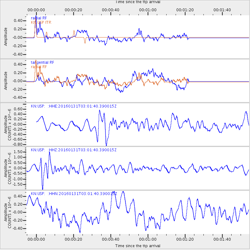
Signal To Noise
| Channel | StoN | STA | LTA |
| KN:USP: :HHZ:20160131T03:01:40.390015Z | 3.1980875 | 7.0858636E-7 | 2.2156567E-7 |
| KN:USP: :HHN:20160131T03:01:40.390015Z | 0.81422454 | 2.7428737E-7 | 3.3686945E-7 |
| KN:USP: :HHE:20160131T03:01:40.390015Z | 2.2202246 | 3.3831444E-7 | 1.5237848E-7 |
| Arrivals |
| Ps | |
| PpPs | |
| PsPs/PpSs | |


