You are here: Home > Network List > TA - USArray Transportable Network (new EarthScope stations) Stations List
> Station L20K Farewell, AK, USA > Earthquake Result Viewer
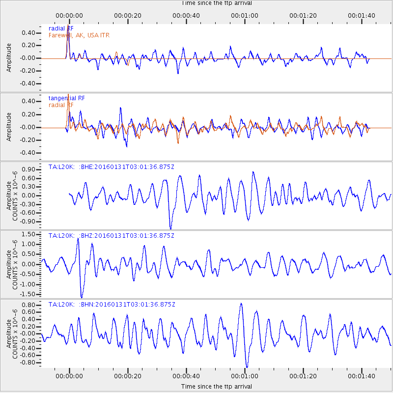
L20K Farewell, AK, USA - Earthquake Result Viewer
*The percent match for this event was below the threshold and hence no stack was calculated.
| Earthquake location: |
Admiralty Islands Region, P.N.G. |
| Earthquake latitude/longitude: |
-2.9/147.1 |
| Earthquake time(UTC): |
2016/01/31 (031) 02:50:06 GMT |
| Earthquake Depth: |
10 km |
| Earthquake Magnitude: |
5.6 MB |
| Earthquake Catalog/Contributor: |
NEIC PDE/NEIC ALERT |
|
| Network: |
TA USArray Transportable Network (new EarthScope stations) |
| Station: |
L20K Farewell, AK, USA |
| Lat/Lon: |
62.48 N/153.88 W |
| Elevation: |
673 m |
|
| Distance: |
78.8 deg |
| Az: |
23.949 deg |
| Baz: |
240.782 deg |
| Ray Param: |
$rayparam |
*The percent match for this event was below the threshold and hence was not used in the summary stack. |
|
| Radial Match: |
63.68349 % |
| Radial Bump: |
400 |
| Transverse Match: |
40.200188 % |
| Transverse Bump: |
400 |
| SOD ConfigId: |
7422571 |
| Insert Time: |
2019-04-21 20:59:50.148 +0000 |
| GWidth: |
2.5 |
| Max Bumps: |
400 |
| Tol: |
0.001 |
|
Signal To Noise
| Channel | StoN | STA | LTA |
| TA:L20K: :BHZ:20160131T03:01:36.875Z | 2.7848887 | 8.040223E-7 | 2.8870892E-7 |
| TA:L20K: :BHN:20160131T03:01:36.875Z | 1.0044459 | 2.2748519E-7 | 2.2647829E-7 |
| TA:L20K: :BHE:20160131T03:01:36.875Z | 2.7592485 | 5.4821714E-7 | 1.986835E-7 |
| Arrivals |
| Ps | |
| PpPs | |
| PsPs/PpSs | |


