You are here: Home > Network List > TA - USArray Transportable Network (new EarthScope stations) Stations List
> Station TPFO Pinon Flats, CA, USA > Earthquake Result Viewer
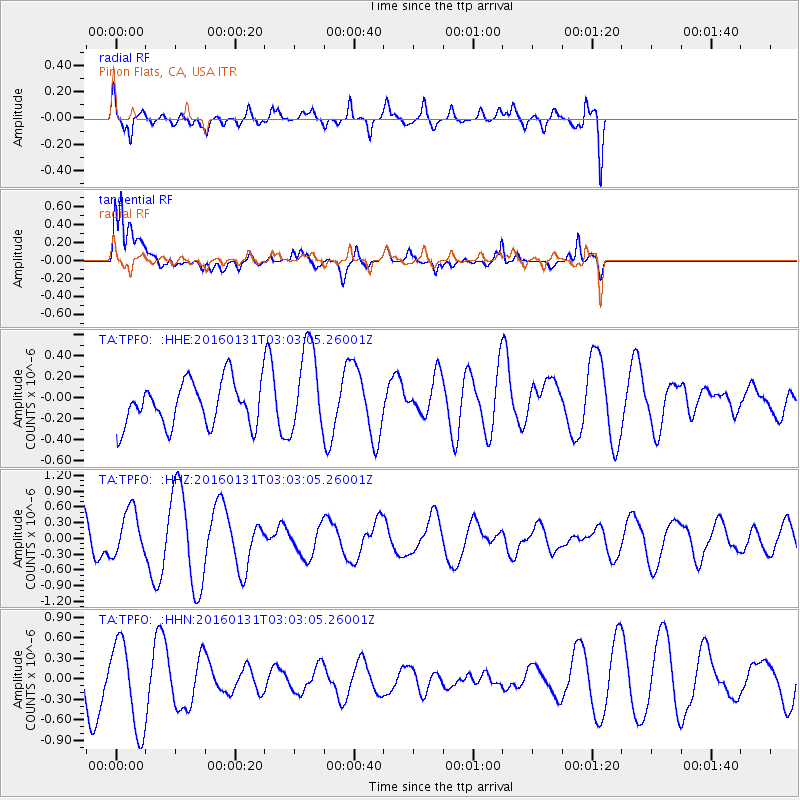
TPFO Pinon Flats, CA, USA - Earthquake Result Viewer
*The percent match for this event was below the threshold and hence no stack was calculated.
| Earthquake location: |
Admiralty Islands Region, P.N.G. |
| Earthquake latitude/longitude: |
-2.9/147.1 |
| Earthquake time(UTC): |
2016/01/31 (031) 02:50:06 GMT |
| Earthquake Depth: |
10 km |
| Earthquake Magnitude: |
5.6 MB |
| Earthquake Catalog/Contributor: |
NEIC PDE/NEIC ALERT |
|
| Network: |
TA USArray Transportable Network (new EarthScope stations) |
| Station: |
TPFO Pinon Flats, CA, USA |
| Lat/Lon: |
33.61 N/116.45 W |
| Elevation: |
1275 m |
|
| Distance: |
96.9 deg |
| Az: |
56.662 deg |
| Baz: |
271.15 deg |
| Ray Param: |
$rayparam |
*The percent match for this event was below the threshold and hence was not used in the summary stack. |
|
| Radial Match: |
52.753204 % |
| Radial Bump: |
400 |
| Transverse Match: |
63.770275 % |
| Transverse Bump: |
400 |
| SOD ConfigId: |
7422571 |
| Insert Time: |
2019-04-21 21:00:03.641 +0000 |
| GWidth: |
2.5 |
| Max Bumps: |
400 |
| Tol: |
0.001 |
|
Signal To Noise
| Channel | StoN | STA | LTA |
| TA:TPFO: :HHZ:20160131T03:03:05.26001Z | 1.339627 | 4.2798544E-7 | 3.1948105E-7 |
| TA:TPFO: :HHN:20160131T03:03:05.26001Z | 1.9702297 | 6.887349E-7 | 3.4957085E-7 |
| TA:TPFO: :HHE:20160131T03:03:05.26001Z | 1.949481 | 4.2110932E-7 | 2.1601099E-7 |
| Arrivals |
| Ps | |
| PpPs | |
| PsPs/PpSs | |


