You are here: Home > Network List > TJ - Tajikistan National Seismic Network Stations List
> Station GARM Garm, Tajikistan > Earthquake Result Viewer
GARM Garm, Tajikistan - Earthquake Result Viewer
*The percent match for this event was below the threshold and hence no stack was calculated.
| Earthquake location: |
Admiralty Islands Region, P.N.G. |
| Earthquake latitude/longitude: |
-2.9/147.1 |
| Earthquake time(UTC): |
2016/01/31 (031) 02:50:06 GMT |
| Earthquake Depth: |
10 km |
| Earthquake Magnitude: |
5.6 MB |
| Earthquake Catalog/Contributor: |
NEIC PDE/NEIC ALERT |
|
| Network: |
TJ Tajikistan National Seismic Network |
| Station: |
GARM Garm, Tajikistan |
| Lat/Lon: |
39.00 N/70.32 E |
| Elevation: |
1305 m |
|
| Distance: |
81.6 deg |
| Az: |
309.923 deg |
| Baz: |
100.581 deg |
| Ray Param: |
$rayparam |
*The percent match for this event was below the threshold and hence was not used in the summary stack. |
|
| Radial Match: |
53.517357 % |
| Radial Bump: |
400 |
| Transverse Match: |
69.48351 % |
| Transverse Bump: |
400 |
| SOD ConfigId: |
7422571 |
| Insert Time: |
2019-04-21 21:00:10.581 +0000 |
| GWidth: |
2.5 |
| Max Bumps: |
400 |
| Tol: |
0.001 |
|
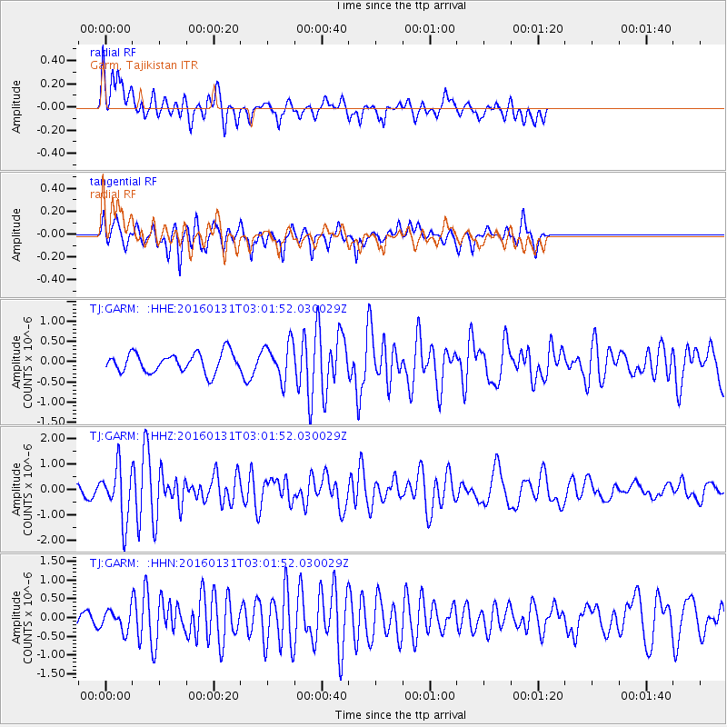
Signal To Noise
| Channel | StoN | STA | LTA |
| TJ:GARM: :HHZ:20160131T03:01:52.030029Z | 3.6089864 | 1.0438794E-6 | 2.8924447E-7 |
| TJ:GARM: :HHN:20160131T03:01:52.030029Z | 1.1208994 | 2.780126E-7 | 2.4802634E-7 |
| TJ:GARM: :HHE:20160131T03:01:52.030029Z | 1.8525254 | 4.4473703E-7 | 2.4007068E-7 |
| Arrivals |
| Ps | |
| PpPs | |
| PsPs/PpSs | |


