You are here: Home > Network List > CI - Caltech Regional Seismic Network Stations List
> Station MPP McPhearson Peak > Earthquake Result Viewer
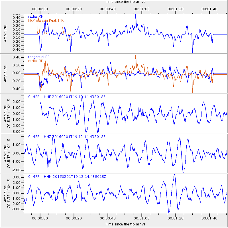
MPP McPhearson Peak - Earthquake Result Viewer
*The percent match for this event was below the threshold and hence no stack was calculated.
| Earthquake location: |
Kermadec Islands Region |
| Earthquake latitude/longitude: |
-31.0/-179.9 |
| Earthquake time(UTC): |
2016/02/01 (032) 19:00:44 GMT |
| Earthquake Depth: |
370 km |
| Earthquake Magnitude: |
5.8 MB |
| Earthquake Catalog/Contributor: |
NEIC PDE/NEIC COMCAT |
|
| Network: |
CI Caltech Regional Seismic Network |
| Station: |
MPP McPhearson Peak |
| Lat/Lon: |
34.89 N/119.81 W |
| Elevation: |
1739 m |
|
| Distance: |
86.6 deg |
| Az: |
45.566 deg |
| Baz: |
228.24 deg |
| Ray Param: |
$rayparam |
*The percent match for this event was below the threshold and hence was not used in the summary stack. |
|
| Radial Match: |
52.674507 % |
| Radial Bump: |
400 |
| Transverse Match: |
56.673325 % |
| Transverse Bump: |
400 |
| SOD ConfigId: |
7422571 |
| Insert Time: |
2019-04-21 21:06:00.526 +0000 |
| GWidth: |
2.5 |
| Max Bumps: |
400 |
| Tol: |
0.001 |
|
Signal To Noise
| Channel | StoN | STA | LTA |
| CI:MPP: :HHZ:20160201T19:12:14.438018Z | 0.6669603 | 5.998443E-7 | 8.993704E-7 |
| CI:MPP: :HHN:20160201T19:12:14.438018Z | 0.9223643 | 8.053318E-7 | 8.7311685E-7 |
| CI:MPP: :HHE:20160201T19:12:14.438018Z | 1.8595605 | 1.8697374E-6 | 1.0054728E-6 |
| Arrivals |
| Ps | |
| PpPs | |
| PsPs/PpSs | |


