You are here: Home > Network List > GS - US Geological Survey Networks Stations List
> Station OK031 2598 S. Brethren Rd., Cushing, OK, USA > Earthquake Result Viewer
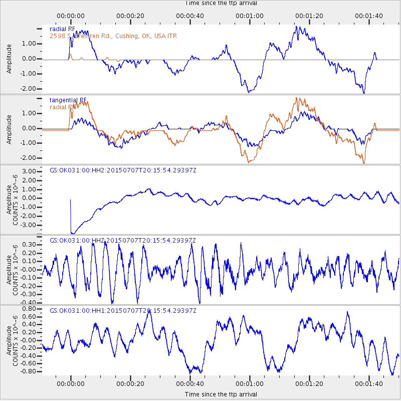
OK031 2598 S. Brethren Rd., Cushing, OK, USA - Earthquake Result Viewer
*The percent match for this event was below the threshold and hence no stack was calculated.
| Earthquake location: |
South Of Fiji Islands |
| Earthquake latitude/longitude: |
-23.1/-177.0 |
| Earthquake time(UTC): |
2015/07/07 (188) 20:03:13 GMT |
| Earthquake Depth: |
120 km |
| Earthquake Magnitude: |
5.8 MO |
| Earthquake Catalog/Contributor: |
NEIC PDE/NEIC ALERT |
|
| Network: |
GS US Geological Survey Networks |
| Station: |
OK031 2598 S. Brethren Rd., Cushing, OK, USA |
| Lat/Lon: |
35.95 N/96.84 W |
| Elevation: |
290 m |
|
| Distance: |
95.8 deg |
| Az: |
53.474 deg |
| Baz: |
245.785 deg |
| Ray Param: |
$rayparam |
*The percent match for this event was below the threshold and hence was not used in the summary stack. |
|
| Radial Match: |
39.30324 % |
| Radial Bump: |
400 |
| Transverse Match: |
44.08107 % |
| Transverse Bump: |
400 |
| SOD ConfigId: |
976571 |
| Insert Time: |
2015-07-21 20:34:51.360 +0000 |
| GWidth: |
2.5 |
| Max Bumps: |
400 |
| Tol: |
0.001 |
|
Signal To Noise
| Channel | StoN | STA | LTA |
| GS:OK031:00:HHZ:20150707T20:15:54.29397Z | 1.6723189 | 1.8199201E-7 | 1.0882613E-7 |
| GS:OK031:00:HH1:20150707T20:15:54.29397Z | 1.0080718 | 2.428198E-7 | 2.408755E-7 |
| GS:OK031:00:HH2:20150707T20:15:54.29397Z | 1.0984995 | 1.5814037E-6 | 1.4396034E-6 |
| Arrivals |
| Ps | |
| PpPs | |
| PsPs/PpSs | |


