You are here: Home > Network List > TA - USArray Transportable Network (new EarthScope stations) Stations List
> Station L04D Klamath Falls, OR, USA > Earthquake Result Viewer
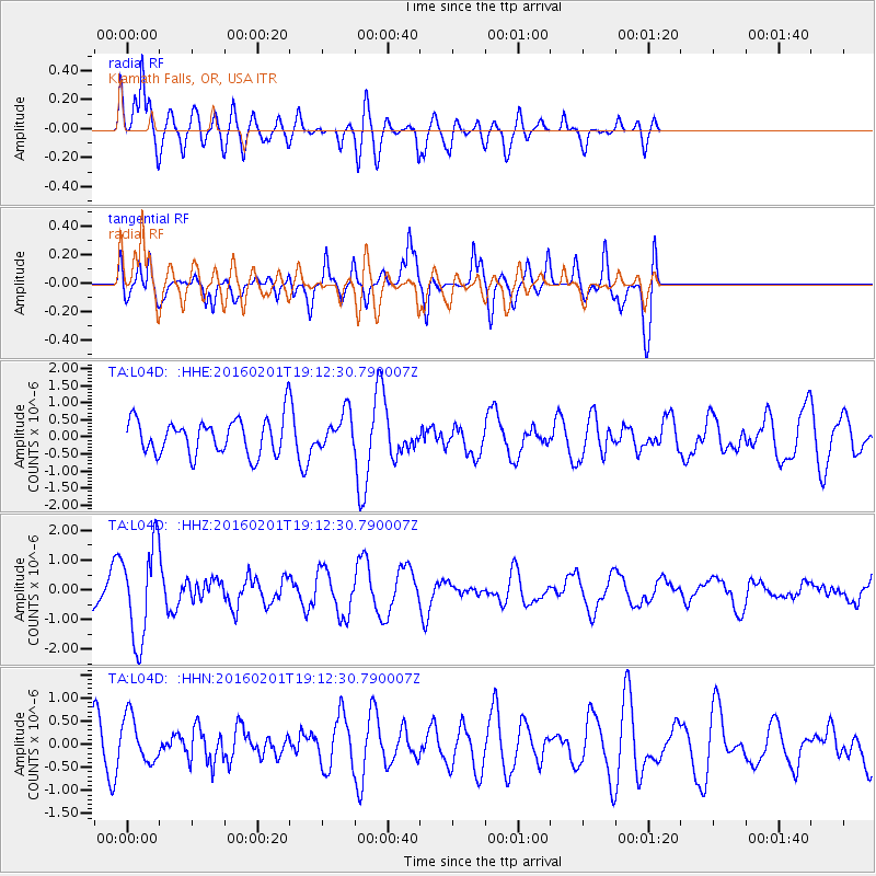
L04D Klamath Falls, OR, USA - Earthquake Result Viewer
*The percent match for this event was below the threshold and hence no stack was calculated.
| Earthquake location: |
Kermadec Islands Region |
| Earthquake latitude/longitude: |
-31.0/-179.9 |
| Earthquake time(UTC): |
2016/02/01 (032) 19:00:44 GMT |
| Earthquake Depth: |
370 km |
| Earthquake Magnitude: |
5.8 MB |
| Earthquake Catalog/Contributor: |
NEIC PDE/NEIC COMCAT |
|
| Network: |
TA USArray Transportable Network (new EarthScope stations) |
| Station: |
L04D Klamath Falls, OR, USA |
| Lat/Lon: |
42.22 N/122.30 W |
| Elevation: |
1437 m |
|
| Distance: |
90.1 deg |
| Az: |
38.857 deg |
| Baz: |
226.494 deg |
| Ray Param: |
$rayparam |
*The percent match for this event was below the threshold and hence was not used in the summary stack. |
|
| Radial Match: |
52.47392 % |
| Radial Bump: |
400 |
| Transverse Match: |
69.141754 % |
| Transverse Bump: |
400 |
| SOD ConfigId: |
7422571 |
| Insert Time: |
2019-04-21 21:08:01.599 +0000 |
| GWidth: |
2.5 |
| Max Bumps: |
400 |
| Tol: |
0.001 |
|
Signal To Noise
| Channel | StoN | STA | LTA |
| TA:L04D: :HHZ:20160201T19:12:30.790007Z | 3.4462793 | 1.5804359E-6 | 4.5859193E-7 |
| TA:L04D: :HHN:20160201T19:12:30.790007Z | 1.2512133 | 5.0104785E-7 | 4.0044955E-7 |
| TA:L04D: :HHE:20160201T19:12:30.790007Z | 1.4149432 | 7.7469E-7 | 5.475061E-7 |
| Arrivals |
| Ps | |
| PpPs | |
| PsPs/PpSs | |


