You are here: Home > Network List > IC - New China Digital Seismograph Network Stations List
> Station WMQ Urumqi, Xinjiang Province, China > Earthquake Result Viewer
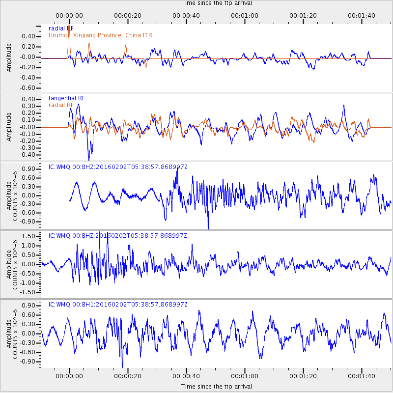
WMQ Urumqi, Xinjiang Province, China - Earthquake Result Viewer
*The percent match for this event was below the threshold and hence no stack was calculated.
| Earthquake location: |
Near East Coast Of Honshu, Japan |
| Earthquake latitude/longitude: |
39.7/143.0 |
| Earthquake time(UTC): |
2016/02/02 (033) 05:31:48 GMT |
| Earthquake Depth: |
18 km |
| Earthquake Magnitude: |
5.6 MB |
| Earthquake Catalog/Contributor: |
NEIC PDE/NEIC COMCAT |
|
| Network: |
IC New China Digital Seismograph Network |
| Station: |
WMQ Urumqi, Xinjiang Province, China |
| Lat/Lon: |
43.81 N/87.70 E |
| Elevation: |
850 m |
|
| Distance: |
40.8 deg |
| Az: |
294.428 deg |
| Baz: |
76.121 deg |
| Ray Param: |
$rayparam |
*The percent match for this event was below the threshold and hence was not used in the summary stack. |
|
| Radial Match: |
51.77005 % |
| Radial Bump: |
400 |
| Transverse Match: |
67.46597 % |
| Transverse Bump: |
400 |
| SOD ConfigId: |
7422571 |
| Insert Time: |
2019-04-21 21:13:11.572 +0000 |
| GWidth: |
2.5 |
| Max Bumps: |
400 |
| Tol: |
0.001 |
|
Signal To Noise
| Channel | StoN | STA | LTA |
| IC:WMQ:00:BHZ:20160202T05:38:57.868997Z | 2.4137704 | 4.869173E-7 | 2.0172477E-7 |
| IC:WMQ:00:BH1:20160202T05:38:57.868997Z | 1.043326 | 3.0862606E-7 | 2.9580977E-7 |
| IC:WMQ:00:BH2:20160202T05:38:57.868997Z | 1.4298465 | 3.164074E-7 | 2.2128766E-7 |
| Arrivals |
| Ps | |
| PpPs | |
| PsPs/PpSs | |


