You are here: Home > Network List > KN - Kyrgyz Seismic Telemetry Network Stations List
> Station TKM2 - > Earthquake Result Viewer
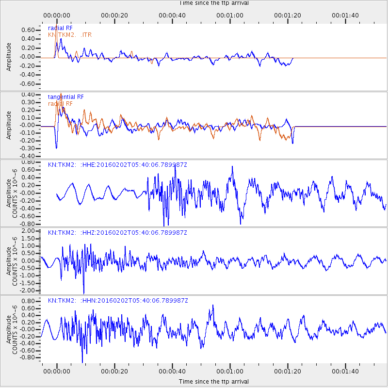
TKM2 - - Earthquake Result Viewer
*The percent match for this event was below the threshold and hence no stack was calculated.
| Earthquake location: |
Near East Coast Of Honshu, Japan |
| Earthquake latitude/longitude: |
39.7/143.0 |
| Earthquake time(UTC): |
2016/02/02 (033) 05:31:48 GMT |
| Earthquake Depth: |
18 km |
| Earthquake Magnitude: |
5.6 MB |
| Earthquake Catalog/Contributor: |
NEIC PDE/NEIC COMCAT |
|
| Network: |
KN Kyrgyz Seismic Telemetry Network |
| Station: |
TKM2 - |
| Lat/Lon: |
42.92 N/75.60 E |
| Elevation: |
2020 m |
|
| Distance: |
49.5 deg |
| Az: |
296.9 deg |
| Baz: |
69.568 deg |
| Ray Param: |
$rayparam |
*The percent match for this event was below the threshold and hence was not used in the summary stack. |
|
| Radial Match: |
50.893494 % |
| Radial Bump: |
386 |
| Transverse Match: |
71.42955 % |
| Transverse Bump: |
400 |
| SOD ConfigId: |
7422571 |
| Insert Time: |
2019-04-21 21:13:33.926 +0000 |
| GWidth: |
2.5 |
| Max Bumps: |
400 |
| Tol: |
0.001 |
|
Signal To Noise
| Channel | StoN | STA | LTA |
| KN:TKM2: :HHZ:20160202T05:40:06.789987Z | 2.0793774 | 4.4661172E-7 | 2.1478147E-7 |
| KN:TKM2: :HHN:20160202T05:40:06.789987Z | 1.3362515 | 2.052146E-7 | 1.5357485E-7 |
| KN:TKM2: :HHE:20160202T05:40:06.789987Z | 1.314573 | 1.8262739E-7 | 1.3892524E-7 |
| Arrivals |
| Ps | |
| PpPs | |
| PsPs/PpSs | |


