You are here: Home > Network List > IU - Global Seismograph Network (GSN - IRIS/USGS) Stations List
> Station PMG Port Moresby, New Guinea > Earthquake Result Viewer
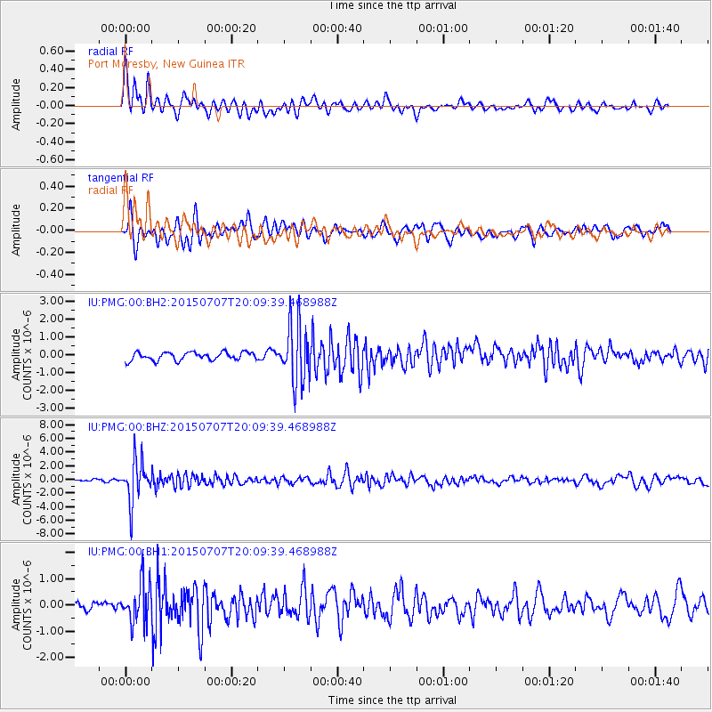
PMG Port Moresby, New Guinea - Earthquake Result Viewer
*The percent match for this event was below the threshold and hence no stack was calculated.
| Earthquake location: |
South Of Fiji Islands |
| Earthquake latitude/longitude: |
-23.1/-177.0 |
| Earthquake time(UTC): |
2015/07/07 (188) 20:03:13 GMT |
| Earthquake Depth: |
120 km |
| Earthquake Magnitude: |
5.8 MO |
| Earthquake Catalog/Contributor: |
NEIC PDE/NEIC ALERT |
|
| Network: |
IU Global Seismograph Network (GSN - IRIS/USGS) |
| Station: |
PMG Port Moresby, New Guinea |
| Lat/Lon: |
9.40 S/147.16 E |
| Elevation: |
90 m |
|
| Distance: |
36.9 deg |
| Az: |
285.722 deg |
| Baz: |
116.063 deg |
| Ray Param: |
$rayparam |
*The percent match for this event was below the threshold and hence was not used in the summary stack. |
|
| Radial Match: |
80.46616 % |
| Radial Bump: |
400 |
| Transverse Match: |
78.577995 % |
| Transverse Bump: |
400 |
| SOD ConfigId: |
976571 |
| Insert Time: |
2015-07-21 20:36:36.614 +0000 |
| GWidth: |
2.5 |
| Max Bumps: |
400 |
| Tol: |
0.001 |
|
Signal To Noise
| Channel | StoN | STA | LTA |
| IU:PMG:00:BHZ:20150707T20:09:39.468988Z | 19.955366 | 3.073621E-6 | 1.5402479E-7 |
| IU:PMG:00:BH1:20150707T20:09:39.468988Z | 3.9963534 | 7.694376E-7 | 1.9253491E-7 |
| IU:PMG:00:BH2:20150707T20:09:39.468988Z | 7.433519 | 1.7009788E-6 | 2.2882553E-7 |
| Arrivals |
| Ps | |
| PpPs | |
| PsPs/PpSs | |


