You are here: Home > Network List > TA - USArray Transportable Network (new EarthScope stations) Stations List
> Station 833A Chaparral WMA, Artesia Wells, TX, USA > Earthquake Result Viewer
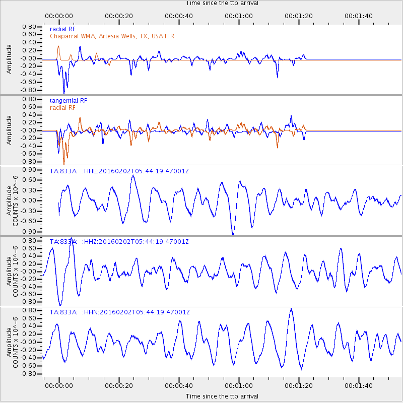
833A Chaparral WMA, Artesia Wells, TX, USA - Earthquake Result Viewer
*The percent match for this event was below the threshold and hence no stack was calculated.
| Earthquake location: |
Near East Coast Of Honshu, Japan |
| Earthquake latitude/longitude: |
39.7/143.0 |
| Earthquake time(UTC): |
2016/02/02 (033) 05:31:48 GMT |
| Earthquake Depth: |
18 km |
| Earthquake Magnitude: |
5.6 MB |
| Earthquake Catalog/Contributor: |
NEIC PDE/NEIC COMCAT |
|
| Network: |
TA USArray Transportable Network (new EarthScope stations) |
| Station: |
833A Chaparral WMA, Artesia Wells, TX, USA |
| Lat/Lon: |
28.32 N/99.39 W |
| Elevation: |
171 m |
|
| Distance: |
90.9 deg |
| Az: |
51.353 deg |
| Baz: |
316.859 deg |
| Ray Param: |
$rayparam |
*The percent match for this event was below the threshold and hence was not used in the summary stack. |
|
| Radial Match: |
83.65908 % |
| Radial Bump: |
383 |
| Transverse Match: |
62.805054 % |
| Transverse Bump: |
400 |
| SOD ConfigId: |
7422571 |
| Insert Time: |
2019-04-21 21:16:11.509 +0000 |
| GWidth: |
2.5 |
| Max Bumps: |
400 |
| Tol: |
0.001 |
|
Signal To Noise
| Channel | StoN | STA | LTA |
| TA:833A: :HHZ:20160202T05:44:19.47001Z | 1.9905971 | 5.839195E-7 | 2.9333884E-7 |
| TA:833A: :HHN:20160202T05:44:19.47001Z | 1.5454874 | 3.2893468E-7 | 2.1283554E-7 |
| TA:833A: :HHE:20160202T05:44:19.47001Z | 1.0872059 | 3.3371762E-7 | 3.069498E-7 |
| Arrivals |
| Ps | |
| PpPs | |
| PsPs/PpSs | |


