You are here: Home > Network List > AK - Alaska Regional Network Stations List
> Station MDM Murphy Dome > Earthquake Result Viewer
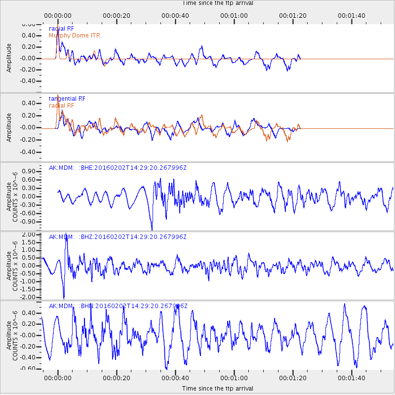
MDM Murphy Dome - Earthquake Result Viewer
*The percent match for this event was below the threshold and hence no stack was calculated.
| Earthquake location: |
Northeast Of Taiwan |
| Earthquake latitude/longitude: |
25.6/123.5 |
| Earthquake time(UTC): |
2016/02/02 (033) 14:19:22 GMT |
| Earthquake Depth: |
188 km |
| Earthquake Magnitude: |
5.8 MB, 5.7 MWB |
| Earthquake Catalog/Contributor: |
NEIC PDE/NEIC COMCAT |
|
| Network: |
AK Alaska Regional Network |
| Station: |
MDM Murphy Dome |
| Lat/Lon: |
64.96 N/148.23 W |
| Elevation: |
634 m |
|
| Distance: |
66.4 deg |
| Az: |
27.657 deg |
| Baz: |
279.967 deg |
| Ray Param: |
$rayparam |
*The percent match for this event was below the threshold and hence was not used in the summary stack. |
|
| Radial Match: |
66.31715 % |
| Radial Bump: |
400 |
| Transverse Match: |
68.162735 % |
| Transverse Bump: |
369 |
| SOD ConfigId: |
7422571 |
| Insert Time: |
2019-04-21 21:19:49.068 +0000 |
| GWidth: |
2.5 |
| Max Bumps: |
400 |
| Tol: |
0.001 |
|
Signal To Noise
| Channel | StoN | STA | LTA |
| AK:MDM: :BHZ:20160202T14:29:20.267996Z | 5.051403 | 9.156345E-7 | 1.812634E-7 |
| AK:MDM: :BHN:20160202T14:29:20.267996Z | 1.027522 | 2.1070187E-7 | 2.0505827E-7 |
| AK:MDM: :BHE:20160202T14:29:20.267996Z | 2.8841615 | 5.0642916E-7 | 1.7558975E-7 |
| Arrivals |
| Ps | |
| PpPs | |
| PsPs/PpSs | |


