You are here: Home > Network List > TA - USArray Transportable Network (new EarthScope stations) Stations List
> Station A21K Barrow, AK, USA > Earthquake Result Viewer
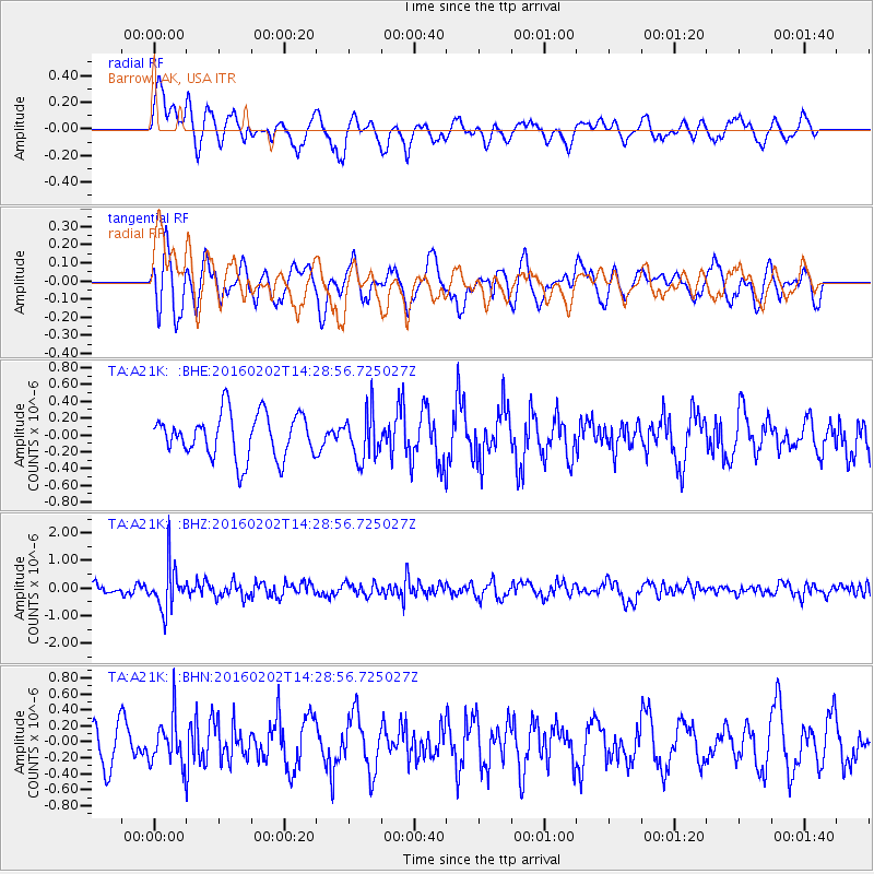
A21K Barrow, AK, USA - Earthquake Result Viewer
*The percent match for this event was below the threshold and hence no stack was calculated.
| Earthquake location: |
Northeast Of Taiwan |
| Earthquake latitude/longitude: |
25.6/123.5 |
| Earthquake time(UTC): |
2016/02/02 (033) 14:19:22 GMT |
| Earthquake Depth: |
188 km |
| Earthquake Magnitude: |
5.8 MB, 5.7 MWB |
| Earthquake Catalog/Contributor: |
NEIC PDE/NEIC COMCAT |
|
| Network: |
TA USArray Transportable Network (new EarthScope stations) |
| Station: |
A21K Barrow, AK, USA |
| Lat/Lon: |
71.32 N/156.62 W |
| Elevation: |
577 m |
|
| Distance: |
62.8 deg |
| Az: |
20.9 deg |
| Baz: |
269.272 deg |
| Ray Param: |
$rayparam |
*The percent match for this event was below the threshold and hence was not used in the summary stack. |
|
| Radial Match: |
55.976845 % |
| Radial Bump: |
400 |
| Transverse Match: |
57.630108 % |
| Transverse Bump: |
400 |
| SOD ConfigId: |
7422571 |
| Insert Time: |
2019-04-21 21:23:57.759 +0000 |
| GWidth: |
2.5 |
| Max Bumps: |
400 |
| Tol: |
0.001 |
|
Signal To Noise
| Channel | StoN | STA | LTA |
| TA:A21K: :BHZ:20160202T14:28:56.725027Z | 4.6397686 | 8.1317313E-7 | 1.7526158E-7 |
| TA:A21K: :BHN:20160202T14:28:56.725027Z | 1.6051158 | 2.9192702E-7 | 1.8187288E-7 |
| TA:A21K: :BHE:20160202T14:28:56.725027Z | 1.0673221 | 2.774007E-7 | 2.5990346E-7 |
| Arrivals |
| Ps | |
| PpPs | |
| PsPs/PpSs | |


