You are here: Home > Network List > US - United States National Seismic Network Stations List
> Station HAWA Hanford, Washington, USA > Earthquake Result Viewer
HAWA Hanford, Washington, USA - Earthquake Result Viewer
*The percent match for this event was below the threshold and hence no stack was calculated.
| Earthquake location: |
South Of Fiji Islands |
| Earthquake latitude/longitude: |
-23.1/-177.0 |
| Earthquake time(UTC): |
2015/07/07 (188) 20:03:13 GMT |
| Earthquake Depth: |
120 km |
| Earthquake Magnitude: |
5.8 MO |
| Earthquake Catalog/Contributor: |
NEIC PDE/NEIC ALERT |
|
| Network: |
US United States National Seismic Network |
| Station: |
HAWA Hanford, Washington, USA |
| Lat/Lon: |
46.39 N/119.53 W |
| Elevation: |
364 m |
|
| Distance: |
86.5 deg |
| Az: |
35.79 deg |
| Baz: |
231.083 deg |
| Ray Param: |
$rayparam |
*The percent match for this event was below the threshold and hence was not used in the summary stack. |
|
| Radial Match: |
66.47533 % |
| Radial Bump: |
400 |
| Transverse Match: |
59.57556 % |
| Transverse Bump: |
400 |
| SOD ConfigId: |
976571 |
| Insert Time: |
2015-07-21 20:39:46.713 +0000 |
| GWidth: |
2.5 |
| Max Bumps: |
400 |
| Tol: |
0.001 |
|
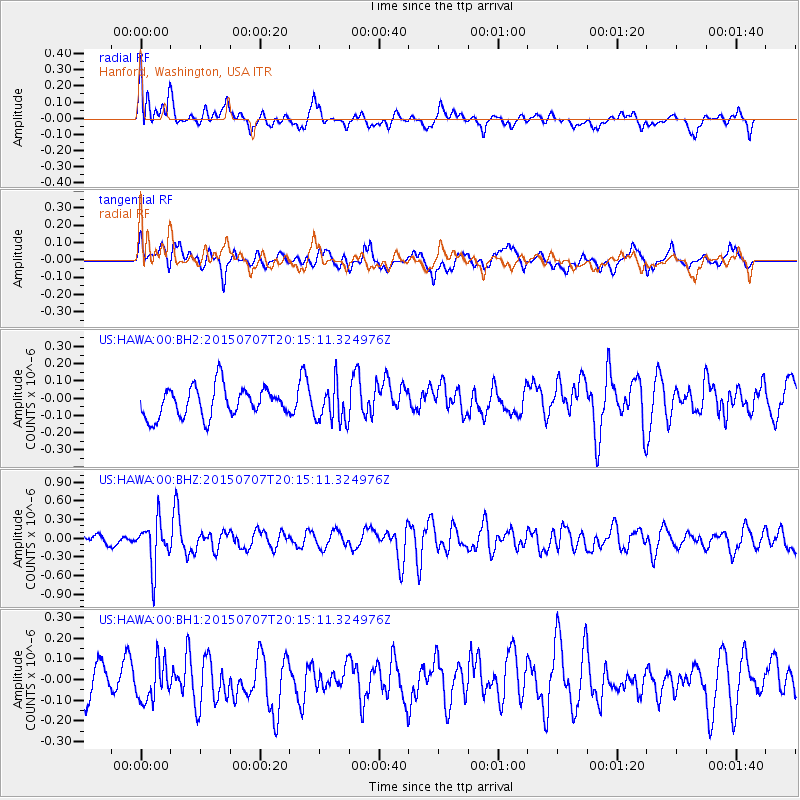
Signal To Noise
| Channel | StoN | STA | LTA |
| US:HAWA:00:BHZ:20150707T20:15:11.324976Z | 4.2542057 | 3.6932735E-7 | 8.6814644E-8 |
| US:HAWA:00:BH1:20150707T20:15:11.324976Z | 1.3356513 | 1.03325156E-7 | 7.735938E-8 |
| US:HAWA:00:BH2:20150707T20:15:11.324976Z | 1.2763042 | 1.11220785E-7 | 8.7142844E-8 |
| Arrivals |
| Ps | |
| PpPs | |
| PsPs/PpSs | |


