You are here: Home > Network List > TA - USArray Transportable Network (new EarthScope stations) Stations List
> Station H17A Grant Village (NPS), Yellowstone Nt. Park, WY, USA > Earthquake Result Viewer
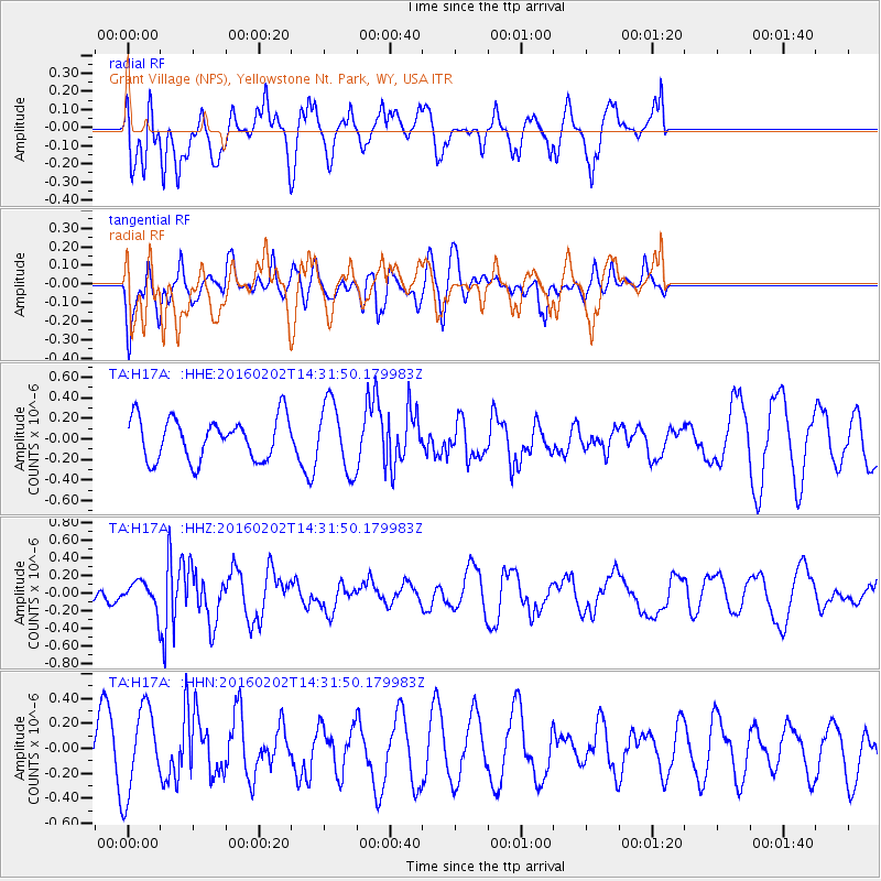
H17A Grant Village (NPS), Yellowstone Nt. Park, WY, USA - Earthquake Result Viewer
*The percent match for this event was below the threshold and hence no stack was calculated.
| Earthquake location: |
Northeast Of Taiwan |
| Earthquake latitude/longitude: |
25.6/123.5 |
| Earthquake time(UTC): |
2016/02/02 (033) 14:19:22 GMT |
| Earthquake Depth: |
188 km |
| Earthquake Magnitude: |
5.8 MB, 5.7 MWB |
| Earthquake Catalog/Contributor: |
NEIC PDE/NEIC COMCAT |
|
| Network: |
TA USArray Transportable Network (new EarthScope stations) |
| Station: |
H17A Grant Village (NPS), Yellowstone Nt. Park, WY, USA |
| Lat/Lon: |
44.40 N/110.58 W |
| Elevation: |
2400 m |
|
| Distance: |
94.6 deg |
| Az: |
35.604 deg |
| Baz: |
312.83 deg |
| Ray Param: |
$rayparam |
*The percent match for this event was below the threshold and hence was not used in the summary stack. |
|
| Radial Match: |
54.084507 % |
| Radial Bump: |
378 |
| Transverse Match: |
44.63828 % |
| Transverse Bump: |
400 |
| SOD ConfigId: |
7422571 |
| Insert Time: |
2019-04-21 21:24:05.870 +0000 |
| GWidth: |
2.5 |
| Max Bumps: |
400 |
| Tol: |
0.001 |
|
Signal To Noise
| Channel | StoN | STA | LTA |
| TA:H17A: :HHZ:20160202T14:31:50.179983Z | 1.3120638 | 1.7123344E-7 | 1.3050695E-7 |
| TA:H17A: :HHN:20160202T14:31:50.179983Z | 2.7635994 | 3.3713752E-7 | 1.2199217E-7 |
| TA:H17A: :HHE:20160202T14:31:50.179983Z | 1.6649196 | 3.359263E-7 | 2.0176728E-7 |
| Arrivals |
| Ps | |
| PpPs | |
| PsPs/PpSs | |


